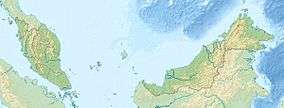
1976 Sabah earthquake
 | |
| Date | 26 July 1976 |
|---|---|
| Origin time | 10:56 MST (UTC+08:00)[1] |
| Magnitude | 6.2 (Mw)[1] |
| Depth | 15 km (9.3 mi)[1] |
| Epicenter | 4°57′22″N 118°18′29″E / 4.956°N 118.308°ECoordinates: 4°57′22″N 118°18′29″E / 4.956°N 118.308°E[1] |
| Type | Normal |
| Areas affected | Tawau Division & Sandakan Division, Sabah, East Malaysia |
| Max. intensity | VII (Very strong)[2] |
The 1976 Sabah earthquake occurred at 10:56 am on 26 July near Lahad Datu in the eastern portion of Sabah, Malaysia.[1] The moment magnitude was 6.2, making it the largest earthquake in Malaysia recorded by seismic instruments. While slightly larger than the 2015 Sabah earthquake (Mw 6.0), the 1976 event caused less extensive damage.
See also
References
- 1 2 3 4 5 "USGS Event Summary". United States Geological Survey. Retrieved 2 May 2016.
- ↑ National Geophysical Data Center / World Data Service (NGDC/WDS), Significant Earthquake Database, National Geophysical Data Center, NOAA, doi:10.7289/V5TD9V7K
This article is issued from Wikipedia - version of the 7/21/2016. The text is available under the Creative Commons Attribution/Share Alike but additional terms may apply for the media files.