42nd parallel north

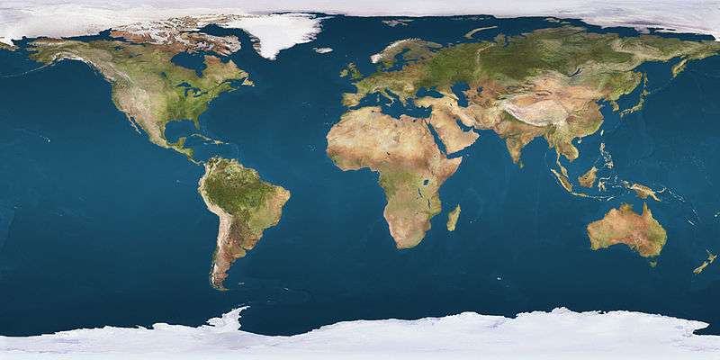
The 42nd parallel north is a circle of latitude that is 42 degrees north of the Earth's equatorial plane. It crosses Europe, the Mediterranean Sea, Asia, the Pacific Ocean, North America, and the Atlantic Ocean.
At this latitude the sun is visible for 15 hours, 15 minutes during the summer solstice and 9 hours, 7 minutes during the winter solstice.[1]
Around the world
Starting at the Prime Meridian and heading eastwards, the parallel 42° north passes through:
United States


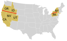
The parallel 42° north forms most of the New York-Pennsylvania border, although due to imperfect surveying in 1785–1786, this boundary wanders around on both sides of the true parallel. The area around the parallel in this region is known as the Twin Tiers.
The 42nd parallel became agreed upon as the northward limit of the Spanish Empire by the Adams-Onís Treaty of 1819 with the United States, which established the parallel as the border between the Viceroyality of New Spain of the Kingdom of Spain and the western territory of the United States of America from the meridian of the headwaters of the Arkansas River west to the Pacific Ocean.[2] The Treaty of Guadalupe Hidalgo of 1848 then ceded much of what was then northern Mexico to the United States; as a result, the northernmost U.S. states which were created from Mexican territory (California, Nevada, and Utah) have the parallel 42° north as their northern border, and the adjoining U.S. states of Oregon and Idaho have the parallel as their southern border.
The parallel passes through the states of Wyoming, Nebraska, Iowa, Illinois, Michigan, Pennsylvania, New York, Connecticut, Rhode Island and Massachusetts, and passes through (or near - within three-tenths degree of latitude) the following cities in the United States:
- Crescent City, California
- Yreka, California
- Ames, Iowa
- Chicago, Illinois
- Kalamazoo, Michigan
- Erie, Pennsylvania
- Jamestown, New York
- Busti, New York
- Binghamton, New York
- Plymouth, Massachusetts
- Springfield, Massachusetts
- Worcester, Massachusetts
- Providence, Rhode Island
Canada
The parallel 42° north passes through the southern end of Lake Michigan and Lake Erie. Part of the water boundary between Canada and the United States passes south of the 42nd parallel. The southern tip of the Canadian province of Ontario just barely goes south of it at Point Pelee and Pelee Island, while the southernmost portion of the Town of Essex at Colchester is located below the 42nd parallel.
See also
- 41st parallel north
- 43rd parallel north
- The Twin Tiers region of New York and Pennsylvania
- The "Jefferson" region of Oregon and California
References
- ↑ http://aa.usno.navy.mil/data/docs/Dur_OneYear.php
- ↑ Nugent, Walter (2008). Habits of Empire: A History of American Expansion. Alfred A. Knopf. pp. 161, 166–167. ISBN 978-1-4000-4292-0.
