Leichhardt Highway
| Leichhardt Highway Queensland | |
|---|---|
 | |
| Leichhardt Highway (green on black) | |
| General information | |
| Type | Highway |
| Length | 577 km (359 mi) |
| Route number(s) |
Westwood - Goondiwindi North Goondiwindi North - Goondiwindi |
| Former route number |
|
| Major junctions | |
| North end |
|
|
| |
| South end |
|
| Location(s) | |
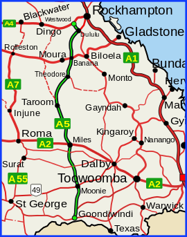
| Major settlements | Dululu, Banana, Theodore, Taroom, Wandoan, Guluguba, Miles, Moonie |
| Highway system | |
|
Highways in Australia National Highway • Freeways in Australia Highways in Queensland | |
| |
The Leichhardt Highway is a major transport route in Queensland, Australia. It is a continuation northward from Goondiwindi of the Newell Highway.[1]
It runs northward from Goondiwindi for nearly 600 kilometres until its termination at the Capricorn Highway near the small town of Westwood.[2]
It is named after Prussian explorer Ludwig Leichhardt who travelled a route in the 19th Century that roughly parallels today's highway.
List of towns along the Leichhardt Highway
Travelling from south to north:
Gallery
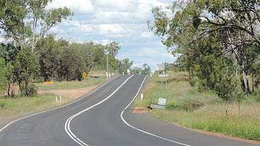 Leichhardt Highway, looking south from Guluguba Cafe, 2014
See also
References
- ↑ Queensland Government - Department of Transport and Main Roads - Maps
- ↑ Hema, Maps (2007). Australia Road and 4WD Atlas (Map). Eight Mile Plains Queensland: Hema Maps. pp. 8/11. ISBN 978-1-86500-456-3.
This article is issued from Wikipedia - version of the 5/13/2016. The text is available under the Creative Commons Attribution/Share Alike but additional terms may apply for the media files.