Ahlat
| Ahlat | |
|---|---|
 Ahlat | |
| Coordinates: 38°45′10″N 42°29′40″E / 38.75278°N 42.49444°ECoordinates: 38°45′10″N 42°29′40″E / 38.75278°N 42.49444°E | |
| Country | Turkey |
| Province | Bitlis |
| Government | |
| • Mayor | Abdulalim Mümtaz Çoban (AKP) |
| • Kaymakam | Bilal Şentürk |
| Area[1] | |
| • District | 989.26 km2 (381.96 sq mi) |
| Population (2012)[2] | |
| • Urban | 21,122 |
| • District | 37,358 |
| • District density | 38/km2 (98/sq mi) |
| Post code | 13400 |
| Website |
www |
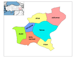
Ahlat (Armenian: Խլաթ, Khlat; Ottoman Turkish: اخلاط; Georgian: ხლათი, Khlati), is a historic town and district in Turkey's Bitlis Province in Eastern Anatolia Region. From 1929-1936, it had been included as a district of Van Province. The town of Ahlat is situated on the northwestern shore of Lake Van. The mayor is Abdulalim Mümtaz Çoban (AKP).
History
Ahlat, known by its Armenian name of Khlat in the ancient and medieval period, was once a part of the district of Bznunik'. During the early eighth century, Arab tribes settled in the region, which lay on the frontier with Byzantium, and it became part of the Arab Kaysite principality.[3] Ibn Hawqal mentioned it as an important stopover point on the Urmia-Mayyafariqin trade route. In the winter of 998, the Curopalates David III of Tao besieged Khlat but was unable to capture it, partly because of his contemptuous treatment towards its Armenian population.[4]
The Shah-Armens, also known as the Ahlahshahs, one of the first Turkish beyliks, was founded in Ahlat by Sökmen el Kutbî, one of the commanders of the Great Seljuq Alp Arslan after the Battle of Manzikert (1071). The Shah-Armens were centered on the northwestern shores of the Lake Van. In the 12th century the city and its adjacent territory was conquered and vassalized by the Kingdom of Georgia. In this period the city was referred to by the Georgian name Khlati.[5] In 1207, the beylik was taken over by the Ayyubids. In 14th and 15th centuries, the district was ruled by Aq Qoyunlu.
In the 11th century accounts of Nasir Khusraw the town of "Akhlat" is mentioned once: "And from there (Van) we arrived at Akhlat on the 18th of Jumada al-awwal and this town marks the borders of Armenians and Muslims, ... an Emir ruled there whom they called Nassr-ol-dolat and had many sons and had appointed them as district governors within his kingdom. In this town three languages are spoken: Taazi (Arabic), Persian, and Armenian and I think that's why they call this town Akhlat (Arabic word from the roots 'Kha-la-ta' which means 'mix, to mix'). They used coins worth 300 Dirhams each."
Ahlat today
Ahlat and its surroundings are known for a large number of historic tombstones left by the Ahlatshah dynasty. Efforts are presently being made by local authorities with a view to including the tombstones on UNESCO's World Heritage List,[6] where they are currently listed tentatively.[7]
In recent years, Ahlat also came to be known for the quality of its potatoes, which carved themselves a sizable share in the Turkish agricultural products market.[8]
Climate
| Climate data for Ahlat | |||||||||||||
|---|---|---|---|---|---|---|---|---|---|---|---|---|---|
| Month | Jan | Feb | Mar | Apr | May | Jun | Jul | Aug | Sep | Oct | Nov | Dec | Year |
| Average high °C (°F) | 1 (33) |
2 (35) |
5 (41) |
11 (51) |
16 (60) |
22 (71) |
27 (80) |
27 (80) |
23 (73) |
16 (60) |
9 (48) |
3 (37) |
13 (55) |
| Average low °C (°F) | −4 (24) |
−4 (24) |
−2 (28) |
2 (35) |
6 (42) |
10 (50) |
15 (59) |
14 (57) |
11 (51) |
6 (42) |
1 (33) |
−2 (28) |
4 (39) |
| Average precipitation cm (inches) | 5 (2) |
6.4 (2.5) |
6.9 (2.7) |
8.6 (3.4) |
8 (3) |
3.3 (1.3) |
0.5 (0.2) |
0.8 (0.3) |
1.5 (0.6) |
6.4 (2.5) |
6.6 (2.6) |
5 (2) |
58.2 (22.9) |
| Source: Weatherbase [9] | |||||||||||||
See also
External links
References
- ↑ "Area of regions (including lakes), km²". Regional Statistics Database. Turkish Statistical Institute. 2002. Retrieved 2013-03-05.
- ↑ "Population of province/district centers and towns/villages by districts - 2012". Address Based Population Registration System (ABPRS) Database. Turkish Statistical Institute. Retrieved 2013-02-27.
- ↑ Ter-Ghewondyan, Aram N. The Arab Emirates in Bagratid Armenia. Trans. Nina G. Garsoïan. Lisbon: Calouste Gulbenkian Foundation, 1976, pp. 32, 144.
- ↑ Ter-Ghewondyan, ''The Arab Emirates in Bagratid Armenia, pp. 113, 139.
- ↑ Lordkipanidze, Mariam; B. Hewitt, George (1987). Georgia in the XI-XII Centuries. Ganatleba Publishers. p. 41.
- ↑ Yüksel Oktay. "On the Roads of Anatolia - Van". Los Angeles Chronicle. Archived from the original on 2007-09-28. External link in
|publisher=(help) - ↑ "Tentative World Heritage Sites". UNESCO.
- ↑ (article) "Türkiye'nin en kaliteli patatesi Ahlat'ta (Turkey's best quality potatoes are in Ahlat" Check
|url=value (help). Kenthaber Association of Local Newspapers of Turkey. External link in|publisher=(help) - ↑ "Weatherbase: Historical Weather for Ahlat, Turkey". Weatherbase. 2011. Retrieved on November 24, 2011.
