Aiyura Airport
| Aiyura Airport | |||||||||||
|---|---|---|---|---|---|---|---|---|---|---|---|
|
Aiyura Valley viewed from road leading in from Kainantu. Aiyura airport is in the background. | |||||||||||
| IATA: AYU – ICAO: AYAY | |||||||||||
| Summary | |||||||||||
| Location | Aiyura, Papua New Guinea | ||||||||||
| Elevation AMSL | 5,100 ft / 1,554 m | ||||||||||
| Coordinates | 06°20′16″S 145°54′14″E / 6.33778°S 145.90389°ECoordinates: 06°20′16″S 145°54′14″E / 6.33778°S 145.90389°E | ||||||||||
| Maps | |||||||||||
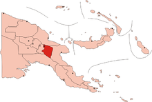
 Eastern Highlands Province of Papua New Guinea | |||||||||||
 AYU Location of the airport in Papua New Guinea | |||||||||||
| Runways | |||||||||||
| |||||||||||
|
Source: PNG Airstrip Guide[1] | |||||||||||
Aiyura Airport (IATA: AYU, ICAO: AYAY) is an airstrip in Aiyura, in the Eastern Highlands Province of Papua New Guinea.[1] It is the main air base for Summer Institute of Linguistics (SIL). The pilots and mechanics who work out of Aiyura Airport live in the nearby SIL town of Ukarumpa.
References
- 1 2 PNG Airstrip Guide. August 2005.
External links
This article is issued from Wikipedia - version of the 12/4/2016. The text is available under the Creative Commons Attribution/Share Alike but additional terms may apply for the media files.