Alabama State Route 215
| ||||
|---|---|---|---|---|
| Route information | ||||
| Maintained by ALDOT | ||||
| Length: | 12.1 mi[1] (19.5 km) | |||
| Major junctions | ||||
| South end: |
| |||
|
| ||||
| North end: |
| |||
| Location | ||||
| Counties: | Tuscaloosa | |||
| Highway system | ||||
| ||||

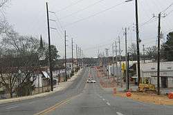
State Route 215, also known as SR-215, is a numbered state highway in Tuscaloosa County, Alabama. SR-215 partially follows the former routes of U.S. Highway 82 and U.S. Highway 11. The route stays almost completely within the city limits of Tuscaloosa.
Route description
The 8-mile (13 km) highway is unusual in that it follows both a north–south and east–west routing (though it is signed as north–south for its entire route). The highway follows the former routing of U.S. Highway 82 and formerly followed the former routing of U.S. Highway 11. Thus, it does not act as a true bypass for either route. Even more strangely, the north–south section parallels US-82, an even-numbered (and therefore east–west) US highway, while the east–west section follows US-11, which is odd-numbered and thus follows a north–south route.
The north–south section is named Old Montgomery Highway and Greensboro Avenue while the east–west section was formerly routed on University Boulevard. In 2015, in order to divert traffic from the campus of the University of Alabama, the east-west segment of the route was removed from University Boulevard and diverted onto Veterans Memorial Parkway, which becomes 15th Street at its intersection with U.S. Highway 82. The route changes direction at the intersection of Greensboro Avenue and 15th Street south of downtown Tuscaloosa.
Major intersections
The entire route is in Tuscaloosa County.
| Location | mi[1] | km | Destinations | Notes |
|---|---|---|---|---|
| Tuscaloosa | 0.0 | 0.0 | Southern terminus | |
| 1.8 | 2.9 | |||
| 7.8 | 12.6 | |||
| 10.7 | 17.2 | |||
| Cottondale | 12.1 | 19.5 | Northern terminus | |
| 1.000 mi = 1.609 km; 1.000 km = 0.621 mi | ||||
References
- 1 2 General Highway Map of Tuscaloosa County (PDF) (Map). Cartography by ALDOT Bureau of Transportation Planning, Survey & Mapping Division. Alabama Department of Transportation. 1999. Archived from the original (PDF) on 2008-11-24.
- ↑ Google (2009-04-28). "SR 215/Southern terminus" (Map). Google Maps. Google. Retrieved 2009-04-28.
- ↑ Google (2009-04-28). "SR 215/US 11" (Map). Google Maps. Google. Retrieved 2009-04-28.
- ↑ Google (2009-04-28). "SR 215/US 82" (Map). Google Maps. Google. Retrieved 2009-04-28.
- ↑ Google (2009-04-28). "SR 215/SR 216" (Map). Google Maps. Google. Retrieved 2009-04-28.
- ↑ Google (2009-04-28). "SR 215/Northern terminus" (Map). Google Maps. Google. Retrieved 2009-04-28.
External links
- Alabama 215 Ends
- Alabama 215 at Southeastroads.com