Aldeby
| Aldeby | |
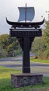
 Welcome to Aldeby |
|
 Aldeby |
|
| Area | 12.61 km2 (4.87 sq mi) |
|---|---|
| Population | 420 (2011) |
| – density | 33/km2 (85/sq mi) |
| OS grid reference | TM450933 |
| District | South Norfolk |
| Shire county | Norfolk |
| Region | East |
| Country | England |
| Sovereign state | United Kingdom |
| Post town | BECCLES |
| Postcode district | NR34 |
| Police | Norfolk |
| Fire | Norfolk |
| Ambulance | East of England |
| EU Parliament | East of England |
Coordinates: 52°28′58″N 1°36′27″E / 52.482719°N 1.607606°E
Aldeby is a village and civil parish in the English county of Norfolk. It is bounded to the south by the River Waveney, on the other side of which is Suffolk. The village is about five miles (8 km) by road from Beccles.
The civil parish has an area of 12.61 square kilometres and in 2001 had a population of 437 in 175 household, falling to a population of 422 in 180 households at the 2011 Census.[1] For the purposes of local government, the parish falls within the area of the district of South Norfolk.

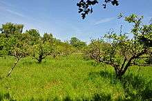
Aldeby is well known for its fishing pits and also historically for the apple factory (Waveney Apple Growers Ltd) based on Common Road that closed in the late 1990s. It also once had its own Aldeby railway station.

Aldeby is mentioned in the Domesday Book and was part of Clavering hundred. Aldeby Priory was located here.
References
- ↑ "Civil Parish population 2011". Neighbourhood Statistics. Office for National Statistics. Retrieved 27 July 2016.
- ^ Office for National Statistics & Norfolk County Council, 2001. Census population and household counts for unparished urban areas and all parishes. Retrieved December 2, 2005.
External links
-
 Media related to Aldeby at Wikimedia Commons
 - Parish Council
- Aldeby in the Domesday Book