Arkansas Highway 100
For the earlier Highway 100, see Arkansas Highway 100 (1926-1960).
| ||||
|---|---|---|---|---|
 | ||||
| Route information | ||||
| Maintained by AHTD | ||||
| Highway system | ||||
| ||||
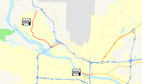
Highway 100 consists of two sections. The eastern portion, located in North Little Rock, runs approximately 2 miles (3.2 km) between U.S. Route 70 and Highway 365. The western portion, begins at Highway 365 near Morgan and runs approximately 9 miles (14 km), ending at Interstate 40 near Crystal Hill. The City of Maumelle is the only other community on this route.
Major intersections
The entire route is in Pulaski County.
| Location | mi | km | Destinations | Notes | |||
|---|---|---|---|---|---|---|---|
| | |||||||
| North Little Rock | I-430 exit 12 | ||||||
| | I-40 exit 148 | ||||||
| Gap in route | |||||||
| North Little Rock | Roundabout | ||||||
| 1.000 mi = 1.609 km; 1.000 km = 0.621 mi | |||||||
This article is issued from Wikipedia - version of the 11/29/2016. The text is available under the Creative Commons Attribution/Share Alike but additional terms may apply for the media files.
