Bansud, Oriental Mindoro
| Bansud | ||
|---|---|---|
| Municipality | ||
|
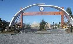
Plaza de Bansud | ||
| ||
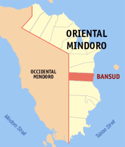
 Map of Oriental Mindoro with location of Bansud | ||
.svg.png) Bansud Location within the Philippines | ||
| Coordinates: 12°50′N 121°22′E / 12.833°N 121.367°ECoordinates: 12°50′N 121°22′E / 12.833°N 121.367°E | ||
| Country | Philippines | |
| Region | MIMAROPA (Region IV-B) | |
| Province | Oriental Mindoro | |
| Congr. district | 2nd district | |
| Barangays | 13 | |
| Government[1] | ||
| • Mayor | Ronaldo Mortel Morada | |
| Area[2] | ||
| • Total | 343.47 km2 (132.61 sq mi) | |
| Population (2010)[3] | ||
| • Total | 38,341 | |
| • Density | 110/km2 (290/sq mi) | |
| Time zone | PST (UTC+8) | |
| ZIP code | 5210 | |
| Dialing code | 43 | |
| Website |
www | |
Bansud is a second class municipality in the province of Oriental Mindoro, Philippines. According to the 2010 census, it has a population of 38,341 people.[3]
Barangays
Bansud is politically subdivided into 13 barangays.[2]
- Alcadesma (formerly Tiguisan)
- Bato
- Conrazon
- Malo
- Manihala
- Pag-asa
- Poblacion
- Proper Bansud
- Rosacara
- Salcedo
- Sumagui
- Proper Tiguisan
- Villa Pag-Asa
Etymology
The name of the town is said to be derived from a legend. The legend says that long ago the Mangyans, the aborigines of the Mindoro settled in the lands near the mouth of Bansud River, which they called “Basud” which means Delta. The delta provided fertile soil for the people; hence they lived there peacefully and productively until the time that settlers from the province of Marinduque and Visayan Islands moved in. In many years that followed, the word “Basud” was eventually changed to Bansud.
Demographics
| Population census of Bansud | ||
|---|---|---|
| Year | Pop. | ±% p.a. |
| 1990 | 26,225 | — |
| 1995 | 31,901 | +3.74% |
| 2000 | 35,032 | +2.03% |
| 2007 | 35,664 | +0.25% |
| 2010 | 38,341 | +2.67% |
| Source: National Statistics Office[3] | ||
References
- ↑ "Official City/Municipal 2013 Election Results". Intramuros, Manila, Philippines: Commission on Elections (COMELEC). 11 September 2013. Retrieved 23 December 2013.
- 1 2 "Province: ORIENTAL MINDORO". PSGC Interactive. Makati City, Philippines: National Statistical Coordination Board. Retrieved 30 October 2012.
- 1 2 3 "Total Population by Province, City, Municipality and Barangay: as of May 1, 2010" (PDF). 2010 Census of Population and Housing. National Statistics Office. Archived from the original (PDF) on 15 November 2012. Retrieved 30 October 2012.
External links
- Philippine Standard Geographic Code
- Philippine Census Information
- Local Governance Performance Management System
 |
Gloria |  | ||
| Sablayan, Occidental Mindoro | |
Sibuyan Sea | ||
| ||||
| | ||||
| Bongabong |
This article is issued from Wikipedia - version of the 10/25/2016. The text is available under the Creative Commons Attribution/Share Alike but additional terms may apply for the media files.

