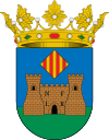
Banyeres de Mariola
| Banyeres de Mariola Bañeres | |||
|---|---|---|---|
| Municipality | |||
| |||
 Banyeres de Mariola Location in Spain | |||
| Coordinates: 38°42′57″N 0°39′26″W / 38.71583°N 0.65722°WCoordinates: 38°42′57″N 0°39′26″W / 38.71583°N 0.65722°W | |||
| Country |
| ||
| Autonomous community |
| ||
| Province | Alicante | ||
| Comarca | Alcoià | ||
| Judicial district | Alcoi | ||
| Government | |||
| • Alcalde | Antonio Belda Valero (2007) (PP) | ||
| Area | |||
| • Total | 50.28 km2 (19.41 sq mi) | ||
| Elevation | 816 m (2,677 ft) | ||
| Population (2009) | |||
| • Total | 7,223 | ||
| • Density | 140/km2 (370/sq mi) | ||
| Demonym(s) | Banyerenc, banyerenca | ||
| Time zone | CET (UTC+1) | ||
| • Summer (DST) | CEST (UTC+2) | ||
| Postal code | 03450 | ||
| Official language(s) | Valencian | ||
| Website | Official website | ||
Banyeres de Mariola (Valencian pronunciation: [baˈɲeɾez ðe maɾiˈɔla], Spanish: Bañeres) is a settlement in the north of the province of Alicante (Spain), 860 metres above sea level, with a population of 7,500. The main employer is the local textile industry. The town has a Moorish castle that dates from 1214, and is surrounded by mountains, almond and olive trees.
From the 22 to the 24 April each year the town celebrates the Moros i Cristians (Moors and Christians) festival, commemorating the 13th century defeat by the Christians of the occupying Moorish rulers. It is a festival of pageantry, costume, and pyrotechnics.
See also
| Wikimedia Commons has media related to Banyeres de Mariola. |
This article is issued from Wikipedia - version of the 4/16/2016. The text is available under the Creative Commons Attribution/Share Alike but additional terms may apply for the media files.

