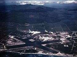
Naval Air Station Barbers Point
| Naval Air Station Barbers Point John Rodgers Field | |||||||||||||||||||
|---|---|---|---|---|---|---|---|---|---|---|---|---|---|---|---|---|---|---|---|
|
| |||||||||||||||||||
|
IATA: none – ICAO: PHJR – FAA LID: JRF – WMO: 91178 | |||||||||||||||||||
| Summary | |||||||||||||||||||
| Airport type | Public | ||||||||||||||||||
| Owner | United States Navy | ||||||||||||||||||
| Location | Kapolei, Hawaii | ||||||||||||||||||
| Elevation AMSL | 30 ft / 9 m | ||||||||||||||||||
| Coordinates | 21°18′26″N 158°04′13″W / 21.30722°N 158.07028°WCoordinates: 21°18′26″N 158°04′13″W / 21.30722°N 158.07028°W | ||||||||||||||||||
| Runways | |||||||||||||||||||
| |||||||||||||||||||

Naval Air Station Barbers Point (ICAO: PHJR, FAA LID: JRF), also called John Rodgers Field (the original name of Honolulu International Airport) is a former United States Navy airfield closed in the 1990s. It was later reopened as Kalaeloa Airport in 1999.
History
NAS Barbers Point was closed by Base Realignment and Closure (BRAC) action in the 1990s, with the Navy aircraft, primarily P-3C Orion maritime patrol aircraft assigned to squadrons of Patrol Wing Two, relocating to Marine Corps Air Station Kaneohe Bay, now Marine Corps Base Hawaii, on the other side of the island. However, Coast Guard Air Station Barbers Point, with its complement of HH-65 Dolphin helicopters and HC-130H Hercules aircraft, remained after the Navy's departure. Coast Guard Air Station Barbers Point is the only Coast Guard Air Station within the 14th United States Coast Guard District. It is also home to Naval Air Museum Barbers Point which preserves the history of the base and also has a collection of aircraft that reflect the US Navy, Marines, and Coast Guards presence on Barbers Point and in the state of Hawaii.
See also
- Hawaii World War II Army Airfields
- HABS/HAER documentation of Naval Air Station Barbers Point for a listing of the very extensive documentation of Naval Air Station Barbers Point by the Historic American Buildings Survey
References
![]() This article incorporates public domain material from the Air Force Historical Research Agency website http://www.afhra.af.mil/.
This article incorporates public domain material from the Air Force Historical Research Agency website http://www.afhra.af.mil/.
- Maurer, Maurer, ed. (1982) [1969]. Combat Squadrons of the Air Force, World War II (PDF) (reprint ed.). Washington, DC: Office of Air Force History. ISBN 0-405-12194-6.
External links
![]() Media related to Naval Air Station Barbers Point at Wikimedia Commons
Media related to Naval Air Station Barbers Point at Wikimedia Commons
- Resources for this airport:
- FAA airport information for JRF
- AirNav airport information for PHJR
- ASN accident history for JRF
- FlightAware airport information and live flight tracker
- NOAA/NWS latest weather observations for PHJR
- SkyVector aeronautical chart for JRF
.svg.png)