Bassari Country
| Bassari Country: Bassari, Fula and Bedik Cultural Landscapes | |
|---|---|
| Name as inscribed on the World Heritage List | |
|
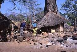
Bedik village | |
| Location |
Salémata Kédougou Senegal |
| Type | Cultural |
| Criteria | iii, v, vi |
| Reference | 1407 |
| UNESCO region | Africa |
| Coordinates | 12°35′36″N 12°50′45″W / 12.59333°N 12.84583°WCoordinates: 12°35′36″N 12°50′45″W / 12.59333°N 12.84583°W |
| Inscription history | |
| Inscription | 2012 (36th Session) |
 Location in Senegal | |
The Bassari Country and its Bassari, Fula and Bedik Cultural Landscapes, located in the southeast of Senegal, is a well-preserved multicultural landscape which emerged from the interaction of human activities and the natural environment. It aggregates three geographical areas: the Bassari–Salémata area, the Bedik–Bandafassi area and the Fula–Dindéfello area, each one with its specifics morphological characteristics.[1]
In 2012, the Bassari Country with its Bassari, Fula and Bedik Cultural Landscapes was added to the UNESCO list of World Heritage Sites.[2]
See also
References
- ↑ "Bassari Country: Bassari, Fula and Bedik Cultural Landscapes". UNESCO. Retrieved 16 May 2015.
- ↑ "Twenty-six new sites inscribed on UNESCO World Heritage List this year". UNESCO. Retrieved 16 May 2015.
This article is issued from Wikipedia - version of the 5/17/2015. The text is available under the Creative Commons Attribution/Share Alike but additional terms may apply for the media files.
