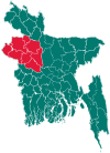
Belkuchi Upazila
{{
| native_name = বেলকুচি
| settlement_type = Upazila
| image_skyline =
| image_caption = Skyline of Belkuchi, Bangladesh
| pushpin_map = Bangladesh
| pushpin_label_position = right
| pushpin_map_caption = Location in Bangladesh
| latd = 24 | latm = 17.5| lats = | latNS = N
| longd = 89 | longm = 42| longs = | longEW = E
| coordinates_display = title
| coordinates_region = BD
| subdivision_type = Country
| subdivision_name = ![]() Bangladesh
| subdivision_type1 = Division
| subdivision_name1 = Rajshahi Division
| subdivision_type2 = District
| subdivision_name2 = Sirajganj District
| leader_title =
| leader_name =
| area_total_km2 = 164.31
| elevation_m =
| population_footnotes =
| population_total = 245164
| population_as_of = 1991
| population_density_km2 = 1492
| timezone = BST
| utc_offset = +6
| postal_code_type =
| postal_code =
| website = www
Bangladesh
| subdivision_type1 = Division
| subdivision_name1 = Rajshahi Division
| subdivision_type2 = District
| subdivision_name2 = Sirajganj District
| leader_title =
| leader_name =
| area_total_km2 = 164.31
| elevation_m =
| population_footnotes =
| population_total = 245164
| population_as_of = 1991
| population_density_km2 = 1492
| timezone = BST
| utc_offset = +6
| postal_code_type =
| postal_code =
| website = www
Geography
Belkuchi is located at 24°17′30″N 89°42′00″E / 24.2917°N 89.7000°E . It has 42413 households and total area 164.31 km². Belkuchi has a very plain land. Belkuchi has two main rivers, Jamuna and Hurasagar. Chandni Beel is an important water body.
Demographics
As of the 2011 Bangladesh census, Belkuchi has a population of 352835. Males constitute 179738 of the population, and females 173097. This upazila's eighteen up population is 116311. Belkuchi has an average literacy rate of 33.6% (7+ years), and the national average of 32.4% literate.[2]
Administration
Belkuchi has 6 unions/wards, 110 mauzas/mahallas, and 132 villages.
See also
References
- ↑ Md Rafiqul Islam (2012), "Belkuchi Upazila", in Sirajul Islam and Ahmed A. Jamal, Banglapedia: National Encyclopedia of Bangladesh (Second ed.), Asiatic Society of Bangladesh
- ↑ "Population Census Wing, BBS.". Archived from the original on 2005-03-27. Retrieved November 10, 2006.
