Boles Fire
| Boles Fire | |
|---|---|
| Location | Weed, Siskiyou County, California |
| Coordinates | 41°25′26″N 122°22′28″W / 41.42384°N 122.37432°W |
| Statistics[1] | |
| Date(s) | September 15, 2014 – September 20, 2014 |
| Burned area | 479 acres (194 ha) |
| Buildings destroyed |
|
| Injuries | 1 |
| Map | |
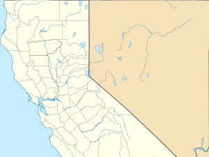
 Location of fire in California | |
The Boles Fire was a wildfire that burned in Siskiyou County during mid-September 2014. On September 15, at 1:38 PM PDT, the Boles Fire ignited near Weed, California. At 10:30 PM PDT, later on the same day, the Boles Fire was reported at 350 acres and 15% containment.[2] Over 100 structures were reported damaged or destroyed on that day. Later that day, the wildfire was reported at nearly 100% containment;[3] however, this report turned out to be erroneous. On September 16, the Boles Fire had burned 375 acres (152 ha) and was only 20% contained. It also destroyed 150 residences and forced the evacuation of 1,500 people in Weed and Siskiyou County.[4][5]
During the next couple of days, the Boles Fire increased to 479 acres (194 ha), before finally being fully contained on September 20.[1] The wildfire also caused 1 injury.[1] The Boles Fire destroyed a total of 150 residential structures and 8 nonresidential commercial properties, while damaging 4 single residences and 3 nonresidential commercial properties.[1] The damage caused by the Boles Fire is currently unknown. The cause of the wildfire was reported as "under investigation."[1]
Ronald Beau Marshall was charged with arson in the Boles Fire case. As of December 5, 2014, Marshall was subject to a preliminary hearing in the matter.[6]
References
- 1 2 3 4 5 "Boles Fire". CAL FIRE. Retrieved 13 August 2015.
- ↑ CalFire (2014-09-15). "Boles Fire Incident Information".
- ↑ "Cal Fire says they have a hose line around Weed fire". Record Searchlight. 2014-09-15.
- ↑ http://kobi5.com/news/item/100-structures-burned-in-boles-fire-in-weed-california.html#.VBjQ3_ldXNk KOBI
- ↑ Associated Press (2014-09-17). "Wind-driven Boles Fire 25-percent contained, 150 structures burned".
- ↑ Amanda Hines Doyle (2014-12-05). "Witnesses testify in Boles Fire arson case". Siskiyou Daily News.