Boston Post Road Historic District (Weston, Massachusetts)
|
Boston Post Road Historic District | |
|
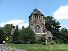
First Parish Church | |
  | |
| Location | Weston, Massachusetts |
|---|---|
| Coordinates | 42°21′57″N 71°18′30″W / 42.36583°N 71.30833°WCoordinates: 42°21′57″N 71°18′30″W / 42.36583°N 71.30833°W |
| Architect | Multiple |
| Architectural style | Georgian, Federal |
| NRHP Reference # | [1] |
| Added to NRHP | February 11, 1983 |
The Boston Post Road Historic District encompasses a portion of the historic roadway known as the Boston Post Road, which ran Boston, Massachusetts to Albany, New York. This surviving alignment in Weston, Massachusetts, extends from Plain Road in the west roughly to Wellesley Street in the east, where it rejoins the modern alignment, now US Route 20. It separates from Route 20 at Highland Street, and forms the main street running through the center of Weston. The roadway is in part significant for its importance in the American Revolutionary War, when it was used by Patriot forces to move men and military supplies. Sites of importance along the road include Lamson Park, where Weston's militia mustered before marching to the Battles of Lexington and Concord in 1775, and the Golden Ball Tavern.[2]
The district was added to the National Register of Historic Places in 1983.[1]
See also
- Boston Post Road Historic District (disambiguation)
- National Register of Historic Places listings in Weston, Massachusetts
References
- 1 2 National Park Service (2008-04-15). "National Register Information System". National Register of Historic Places. National Park Service.
- ↑ "MACRIS inventory record for Weston Old Boston Post Road". Commonwealth of Massachusetts. Retrieved 2014-03-18.

