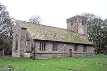
Bracewell and Brogden
| Bracewell and Brogden | |
 New House |
|
 Bracewell and Brogden |
|
| Population | 244 (2011) |
|---|---|
| OS grid reference | SD860484 |
| Civil parish | Bracewell and Brogden |
| District | Pendle |
| Shire county | Lancashire |
| Region | North West |
| Country | England |
| Sovereign state | United Kingdom |
| Post town | SKIPTON |
| Postcode district | BD23 |
| Post town | BARNOLDSWICK |
| Postcode district | BB18 |
| Dialling code | 01282 |
| Police | Lancashire |
| Fire | Lancashire |
| Ambulance | North West |
| EU Parliament | North West England |
| UK Parliament | Pendle |
|
|
Coordinates: 53°55′55″N 2°12′43″W / 53.932°N 2.212°W
Bracewell and Brogden is a civil parish in the West Craven area of the Borough of Pendle in Lancashire, England. According to the 2001 census it had a population of 238, increasing slightly to 244 at the 2011 Census.[1] The parish includes Bracewell (at grid reference SD863485) and Brogden (at SD858472, historically both were in the West Riding of Yorkshire.
Toponymy
Bracewell: from a personal name, either Braegd or Breiđ, + 'well' = 'spring or stream': hence, 'Braegd's/Breiđ's spring or stream' [2]
Brogden: 'The valley of the brook'.[3]
History
The old Roman road from Ribchester to Ilkley passes through the parish, with the remains of a 4th-century Romano-British farmstead known as Bomber Camp located next to the boundary with Gisburn.[4]
See also
References
- ↑ "Civil Parish population 2011". Neighbourhood Statistics. Office for National Statistics. Retrieved 19 January 2016.
- ↑ Ekwall, Eilert (1960). The Concise Oxford Dictionary of English Place-names (4th ed.). Oxford: Clarendon Press.
- ↑ Ekwall, Eilert (1960). The Concise Oxford Dictionary of English Place-names (4th ed.). Oxford: Clarendon Press.
- ↑ Historic England. "Bomber Camp Romano-British farmstead (1013817)". National Heritage List for England. Retrieved 17 March 2016.
External links
![]() Media related to Bracewell and Brogden at Wikimedia Commons
Media related to Bracewell and Brogden at Wikimedia Commons
