Bubaqra
| Bubaqra | |
|---|---|
| Administrative Committee | |
| Kumitat Amministrattiv ta' Bubaqra | |
|
| |
| Country |
|
| Island | Malta |
| Suburb of |
|
| Population | |
| • Total | 2,000 |
| Time zone | CET (UTC+1) |
| • Summer (DST) | CEST (UTC+2) |
| Postal code | ZRQ |
| Dialing code | 356 |
Bubaqra is a hamlet with its own administrative division in Żurrieq, Malta.[1] It is a small rural village situated between Nigret and Ħal Far. Has a population of 2,000 people. Even though it is one of the oldest areas in this village, many new buildings are being constructed and this area is searched most by newlyweds who come to live in this quiet, airy area. At the centre of this zone, a small church is situated, dedicated to our Holy Mary. A few metres away, there is also the churchyard of this village dedicated to St. Leon.
Overview
The original name Bvbakra literally means father of the cows.[2][3]
However, the name of this area originated from Bubakra (from Bakkar), literally meaning 'to wake up early'. With the surrounding area consisting of mainly fields and rural areas, the people of this area used to "get up early to start working their fields". (Dejr el Bakar means house (territory) of the cows[4])
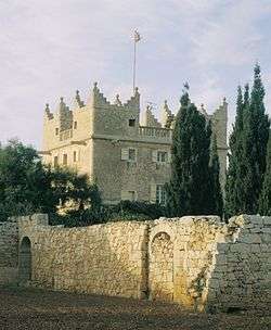
In around 1579, the Bubaqra Tower was built on the outskirts of this zone. It was built as a country retreat by a member of the Order of St. John, and was used for defensive purposes at some points. The tower is currently privately owned, and it has been restored.[5]
References
- ↑ http://www.timesofmalta.com/articles/view/20140907/arts-entertainment/Artistic-anarchy-in-Bubaqra.534856
- ↑ Abela, Giovanni Francesco (1647). Della Descrizione di Malta Isola nel Mare Siciliano con le sue Antichità, ed Altre Notizie (in Italian). Paolo Bonacota. p. 103.
- ↑ bart.), sir Grenville Temple Temple (10th (1836-01-01). Excursions in the Mediterranean. p. 204.
- ↑ Abela, Giovanni Francesco (1647). Della Descrizione di Malta Isola nel Mare Siciliano con le sue Antichità, ed Altre Notizie (in Italian). Paolo Bonacota. p. 95.
- ↑ Attard, Mary (22 November 2014). "Preti, Ball and catacombs". Times of Malta. Archived from the original on 20 November 2015.
External links
Coordinates: 35°49′31.1″N 14°28′46.5″E / 35.825306°N 14.479583°E
