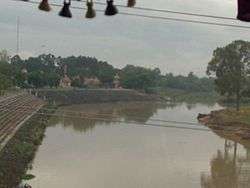
Buriram Province
| Buriram บุรีรัมย์ | ||
|---|---|---|
| Province | ||
|
| ||
| ||
 Map of Thailand highlighting Buriram Province | ||
| Country | Thailand | |
| Capital | Buriram | |
| Government | ||
| • Governor | Anuson Kaeokangwan (since October 2016) | |
| Area | ||
| • Total | 10,322.9 km2 (3,985.7 sq mi) | |
| Area rank | Ranked 17th | |
| Population (2014) | ||
| • Total | 1,579,248[1] | |
| • Rank | Ranked 5th | |
| • Density rank | Ranked 27th | |
| HDI | ||
| • HDI (2009) | 0.729 (medium) (45th) | |
| Time zone | ICT (UTC+7) | |
| Area code(s) | 044 | |
| ISO 3166 code | TH-31 | |
| Vehicle registration | บุรีรัมย์ | |
Buriram (Thai: บุรีรัมย์, rtgs: Buri Ram, pronounced [bū.rīː rām]) is one of the northeastern provinces (changwat) of Thailand. Neighboring provinces are (from south clockwise) Sa Kaeo, Nakhon Ratchasima, Khon Kaen, Maha Sarakham, and Surin. To the southeast it borders Oddar Meancheay of Cambodia. The name Buriram means city of happiness.
Geography
Buriram is at the south end of the Khorat Plateau, with several extinct volcanoes around the province. The southern limit of the province is a mountainous area at the limit between the Sankamphaeng Range and the Dângrêk Mountains.
History

About a thousand years ago, the area that makes up today's Buriram Province was under the Khmer Empire and many ruins remain from that time. The largest, standing on an extinct volcano, is in the Phanom Rung historical park. According to an inscription found there, its local ruler recognised the authority of the Khmer king. However, the area was remote and sparsely populated, and little is recorded about it until it the Bangkok Period of Thai history. In the early nineteenth century, Muang Pae, the largest town, acknowledged Thai sovereignty and was renamed Buriram. Following administrative reforms in the late nineteenth century, Buriram was formally incorporated into Thailand as a province with its own governor.
Culture
Festivals
Aside from important religious days, Songkran Day and New Year's Day, Buriram also has other local festivals such as the festival of the 5th lunar month[2] when the locals make merit, bathe Buddha images and the aged, play traditional sports such as Saba and tug of war. In some areas like Amphoe Phutthaisong, there is the Bang Fai traditional rocket dance, Khao Phansa, at the beginning of Buddhist Lent and Loy Krathong.

Demographics

Buriram is one of the northeastern provinces with a sizable Northern Khmer population. Lao is spoken by most, but according to the most recent census 27.6 percent of the population also speak northern Khmer in everyday life.
Symbols

The provincial seal depicts Phanom Rung temple, an impressive Khmer-style Hindu shrine dedicated to Shiva. It was in use from the 9th through the 12th centuries, when the Khmer Empire's control of the region was ended by the Thais of Ayutthaya kingdom. The ruins are now preserved in a historical park.
The provincial flower is the yellow cotton tree (Cochlospermum regium). The provincial tree is the pink shower (Cassia grandis).
The province's motto is "the city of sandstone sanctuaries, land of volcanoes, beautiful silk, and rich culture".
Administrative divisions

The province is divided into 23 districts (amphoe). The districts are further subdivided into 189 sub-districts (tambon) and 2,212 villages (muban).
Sports
Buriram United is currently the most successful football team in Thailand after sweeping all before them last season by winning the league, the FA Cup, the League Cup and reaching the last eight of the Asian Champions League.
A racing circuit, Buriram United International Circuit, is near the already impressive New I-Mobile Stadium just outside town.
Politics
Senators
- Karoon Sai-ngam (Thai:การุณ ใสงาม)
- Porn Penpas (Thai:พร เพ็ญพาส)
- Permpoon Thongsri (Thai:เพิ่มพูน ทองศรี)
- Surapong Painual (Thai:สุรพงศ์ ไผ่นวล)
- Oudsanee Chidchob (Thai:อุษณีย์ ชิดชอบ)
References
- ↑ "Population of the Kingdom" (PDF). Department of Provincial Affairs (DOPA) Thailand (in Thai). 2014-12-31. Retrieved 19 Mar 2015.
- ↑ "Gregorian-Lunar Calendar Conversion Table". Hong Kong Observatory. Retrieved 1 October 2016.
External links
| Wikimedia Commons has media related to Buriram Province. |
 Buriram travel guide from Wikivoyage
- Tourism Authority of Thailand: Buriram
- Buriram Times
- Provincial website (Thai)
- Buriram provincial map, coat of arms and postal stamp
 |
Khon Kaen Province | Maha Sarakham Province |  | |
| Nakhon Ratchasima Province | |
Surin Province | ||
| ||||
| | ||||
| Sa Kaew Province | Banteay Meanchey Province, |
Oddar Meanchey Province, |
Coordinates: 14°59′39″N 103°6′8″E / 14.99417°N 103.10222°E

