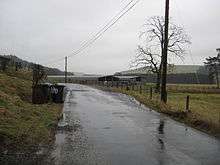
Burnfoot, Roberton, Scottish Borders
For the area of Hawick, see Burnfoot, Scottish Borders.

Road through Burnfoot
Burnfoot (Scottish Gaelic: Bun na h-Aibhne) is a hamlet in the Scottish Borders area of Scotland, close to Roberton, by the Borthwick Water. The nearest town is Hawick to the east, and other places nearby include the Alemoor Loch, Branxholme, Broadhaugh, the Craik Forest. The meaning of Burnfoot is "Place at the foot of the burn".
See also
External links
- RCAHMS record for Burnfoot, Roberton, Scottish Borders
- Old Roads of Scotland: Craik Cross to Hawick via Roberton and Burnfoot
- Hawick Cycle Trail via Burnfoot and Roberton
- Water and Environment Journal: Survey of Sheep-Dipping Practices in the River Tweed Catchment (pollution)
- The Non-Celtic Place-Names of the Scottish Border Counties, by May G. Williamson, Edinburgh University 1942
Coordinates: 55°24′26″N 2°55′45″W / 55.40733°N 2.92923°W
This article is issued from Wikipedia - version of the 5/10/2014. The text is available under the Creative Commons Attribution/Share Alike but additional terms may apply for the media files.