Byfield, Queensland
| Byfield Queensland | |||||||||||||
|---|---|---|---|---|---|---|---|---|---|---|---|---|---|
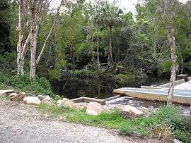
 Waterpark Creek, Byfield | |||||||||||||
 Byfield | |||||||||||||
| Coordinates | 22°50′0″S 150°40′0″E / 22.83333°S 150.66667°ECoordinates: 22°50′0″S 150°40′0″E / 22.83333°S 150.66667°E | ||||||||||||
| Population | 261 (2011 census)[1] | ||||||||||||
| Postcode(s) | 4703 | ||||||||||||
| Location |
| ||||||||||||
| LGA(s) | Shire of Livingstone | ||||||||||||
| State electorate(s) | Keppel | ||||||||||||
| Federal Division(s) | Capricornia | ||||||||||||
| |||||||||||||
Byfield is a locality in Central Queensland, Australia. Byfield is located in the midst of the Byfield National Park, 717 kilometres (446 mi) north west of the state capital Brisbane and 78 kilometres (48 mi) north of the regional centre of Rockhampton. It is within the local government area of Shire of Livingstone (between 2008 and 2013, it was within the Rockhampton Region). In the 2011 census, Byfield had a population of 261 people.[1]
History
At the 2006 census, Byfield had a population of 275.[2]
Heritage listings
Byfield has a number of heritage-listed sites, including:
- 2312 Byfield Road: Raspberry Creek Homestead[3]
- between Byfield Road and Richters Road: Old Byfield Road[4]
References
- 1 2 Australian Bureau of Statistics (31 October 2012). "Byfield". 2011 Census QuickStats. Retrieved 27 December 2015.
- ↑ Australian Bureau of Statistics (25 October 2007). "Byfield (L) (Urban Centre/Locality)". 2006 Census QuickStats. Retrieved 31 January 2011.
- ↑ "Raspberry Creek Homestead (entry 600658)". Queensland Heritage Register. Queensland Heritage Council. Retrieved 12 July 2013.
- ↑ "Old Byfield Road and Stone-Pitched Crossing (entry 601746)". Queensland Heritage Register. Queensland Heritage Council. Retrieved 12 July 2013.
External links
![]() Media related to Byfield, Queensland at Wikimedia Commons
Media related to Byfield, Queensland at Wikimedia Commons
This article is issued from Wikipedia - version of the 7/17/2016. The text is available under the Creative Commons Attribution/Share Alike but additional terms may apply for the media files.