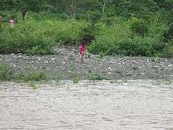
Canat, Marinduque
| Barangay Canat | ||
|---|---|---|
| Barangay | ||
 | ||
| ||
| Country | Philippines | |
| Region | Mimaropa (Region IV-B) | |
| Province | Marinduque | |
| Municipality | Boac | |
| Government | ||
| • Type | Barangay | |
| Area | ||
| • Total | 6.63 km2 (2.56 sq mi) | |
| Population (2010[1]) | ||
| • Total | 649 | |
| • Density | 98/km2 (250/sq mi) | |
| based on 2010 census | ||
| Time zone | PST (UTC+8) | |
| Area code(s) | (+63) | |
| Website |
canatboac | |
Canat (Tagalog pronunciation: [kanˈnat]) is one of the 61 barangays of the municipality of Boac, Marinduque[2] in the Philippines, it is situated in the southern portion of the province. Canat is surrounded by mountains and the Boac River. It has 5.3 kilometers away from the town proper. it has a land total of 6.63 km2 , it will take you from the town proper with the long distance of 5.3 km within 2 to 3 hours depending on the type of vehicles you are riding off. Canat has a rugged, mountainous landscape and it is frequently used for agricultural purposes.
Its name came from the historical story of American armies which attempted to enslave the country.[3]
Barangay Canat dominants are engaged into farming, handicrafts, copra and charcoal.
History
Canat came from the words I cannot which refers to the exhaustion of climbing the mountainous area. The story was started by American soldiers pertaining to the isolated areas of Boac.
But in other old stories in the ancientors, the place was surrounded by carnivorous animals, or in other words, a monster. But that is story is hearsay or just created by some people to create a legend in bad faith.
Demographics
Canat is a developing barangay of Boac, Marinduque. It has more than 640 residents in various living status.[1]
Language
Tagalog is the main languages of the barangay residents but English are uses at the social gatherings and other major activities and some words are accentuated by Marinduqueños accent.
Subdivisions
The barangay is divided into 7 sitios.
- Bananay I
- Bananay II
- Pagsangahan
- Goygoy
- Can-Araw
- Canat Proper
- Mangkalog
Climate and Tourism
The climate is tropical, with a lowland temperature of 27’C (80’F). Temperature may vary between day and night while, the high and low altitudes than between seasons. It receives rain, like other areas in the Philippines that receives more than 1,780mm (70 in) of rain a year. Among the tourist attractions in the barangay are the Bakas ng Higante, Can-Araw Falls, and Can-Araw Cave.
Education

The barangay hosts the Canat Elementary School which was established in 1939.[4]
Governance
Barangay Canat is governed by barangay officials. They are:
- Barangay Captain
- Secretary
- Treasurer
- SB Members
- SK Chairman
- Lupon
Barangay official names and positions
Captain
- Rene Justiniane
Treasurer
- Reynante Mayorga
Secretary
- Angeline Labog
References
- 1 2 "LGU Profile". Municipality of Boac. Retrieved 25 October 2012.
- ↑ Canat_one of the 61 barangays of Boac, Marinduque Province
- ↑ Phil. Barangay_Philippines
- ↑ "school settlement". Municipality of Boac. Retrieved 25 October 2012.
External links
| Wikivoyage has a travel guide for Canat. |
| Wikimedia Commons has media related to Canat Boac Marinduque. |
- www.marinduque.com
- www.Zamboanga.com, Canat (highlight), [Wikipedia]
- Philippines Postcode Database, Postal Code and Address (Canat)
