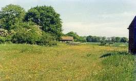
Capel railway station
| Capel | |
|---|---|
|
Site of the station in 1985 | |
| Location | |
| Place | Capel St Mary |
| Area | Suffolk |
| Operations | |
| Original company | Eastern Union & Hadleigh Junction Railway[1] |
| Pre-grouping | Great Eastern Railway |
| Post-grouping | London and North Eastern Railway |
| Platforms | 1 |
| History | |
| 2 Sep 1847 | Opened[1] |
| 29 Feb 1932 | Closed to passengers |
| Disused railway stations in the United Kingdom | |
|
Closed railway stations in Britain A B C D–F G H–J K–L M–O P–R S T–V W–Z | |
|
| |
Capel railway station was a station in Capel St Mary, Suffolk, on a short branch line from Bentley Junction to Hadleigh. The station buildings were remarkably ornate for a village with a population of 649 in 1851 and 504 in 1931. There were goods sidings on the northern side of the station,which were used extensively in World War II handling supplies to a nearby United States Army Air Forces base,[2] later known as RAF Raydon.
| Preceding station | Disused railways | Following station | ||
|---|---|---|---|---|
| Raydon Wood Line and station closed |
Great Eastern Railway Eastern Union and Hadleigh Junction Railway |
Bentley Church Line and station closed | ||
The line opened in 1847 and closed to passenger traffic in 1932, with freight services lingering on until 1965.
References
- 1 2 Butt, R. V. J. (1995). The Directory of Railway Stations: details every public and private passenger station, halt, platform and stopping place, past and present (1st ed.). Sparkford: Patrick Stephens Ltd. ISBN 1-8526-0508-1. OCLC 60251199.
- ↑ Mitchell, Vic (June 2011). Branch Lines to Harwich and Hadleigh. Midhurst: Middleton Press. plans XI, XII and plate 107. ISBN 978 1 908174 02 4.
External links
Coordinates: 52°00′30″N 1°03′42″E / 52.00838°N 1.06177°E
This article is issued from Wikipedia - version of the 1/18/2016. The text is available under the Creative Commons Attribution/Share Alike but additional terms may apply for the media files.
