Cherry Lake (Victoria)
| Cherry Lake | |
|---|---|
 | |
| Location | City of Hobsons Bay, Victoria |
| Coordinates | 37°51′30″S 144°50′5″E / 37.85833°S 144.83472°ECoordinates: 37°51′30″S 144°50′5″E / 37.85833°S 144.83472°E |
| Type | Storm water drain |
| Basin countries | Australia |
| Average depth | 1 metre |
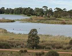
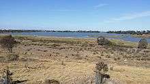
Cherry Lake is part of historical coastal wetlands in Altona, a suburb of Melbourne, Australia. The wetlands were converted to a lake with construction of retaining walls, levees, and flow channels.[1] The lake and surrounding reserve is an important wildlife habitat and popular recreational destination.[2]
Flora and fauna
Cherry Lake and nearby Truganina Swamp are habitat for the native sedge, chaffy sawsedge (Gahnia filum). The sedgefields provide food and habitat for the endangered Altona skipper butterfly (Hesperilla flavescens flavescens).[3]
The lake and associated salt marsh vegetation provides habitat for pelicans, black swans and purple swamphens.[4]
Weed control is carried out on a regular basis, targeting spiny rush, serrated tussock and boxthorn.
Mosquito larvae numbers are monitored and a biological agent is occasionally utilised for control. Rabbit control is also undertaken.[1]
Construction
The lake was created in the 1960s as a flood retention basin for residential expansion in Altona and Brooklyn. Prior to this, it was a motor racing circuit, constructed in 1954 at a cost of 35,000 pounds.[1][5]
Levees were constructed on the south and east side of the lake with a spillway and channel which discharges excess water to Port Phillip Bay. These help to maintain a relatively constant water level of around one metre in depth. An additional higher levee bank was constructed to prevent floodwaters from Kororoit Creek sweeping across the lake toward residential areas.[1]
Recreational and community use

The lake attracts boats, windsurfers and anglers. Waterbirds can be viewed from a bird hide.[2]
A 3.7 kilometre long shared walking and bicycle path encircles the lake, connected to the Hobsons Bay Coastal Trail. Other facilities in the reserve include a playground, picnic shelter, barbecue, seating, toilets and car park which is accessed from Millers Road.[4] The Altona Lions Club hold an outdoor market on the first Sunday of every month (and the third Sunday in December) on the Miller Street frontage of the park.[6]
References
- 1 2 3 4 "Cherry Lake and Truganina Swamp" (PDF). Infostream. Melbourne Water. November 2000. Retrieved 2008-04-02.
- 1 2 "Altona, Victoria - Travelmate". Retrieved 2008-05-04.
- ↑ Relf, C.; T. R. New (2008-01-30). "Conservation needs of the Altona skipper butterfly, Hesperilla flavescens flavescens Waterhouse (Lepidoptera: Hesperiidae), near Melbourne, Victoria". Journal of Insect Conservation. Springer Netherlands.
- 1 2 "Cherry Lake, Altona". Hobsons Bay City Council. Retrieved 2008-05-03.
- ↑ http://nla.gov.au/nla.news-article70698796?
- ↑ "Altona Sunday Market". Retrieved 2008-05-04.
External links
| Wikivoyage has a travel guide for Melbourne/Altona. |
- Beautiful Altona
- Picturesque Altona
- Hobsons Bay Community Online Forum
- Attractions of Altona Map
- Facebook Page on Events & Activities in Altona
- "Friends of Cherry Lake"