Chittenango Falls State Park
| Chittenango Falls State Park | |
|---|---|
|
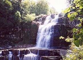
Photo of Chittenango Falls taken in May from the footbridge spanning the creek. | |
 Location of Chittenango Falls State Park within New York State | |
| Type | State park |
| Location |
2300 Rathbun Road Cazenovia, New York[1] |
| Nearest city | Syracuse, New York |
| Coordinates | 42°59′N 75°51′W / 42.98°N 75.85°WCoordinates: 42°59′N 75°51′W / 42.98°N 75.85°W |
| Area | 193 acres (0.78 km2)[2] |
| Created | 1922[3] |
| Operated by | New York State Office of Parks, Recreation and Historic Preservation |
| Visitors | 46,988 (in 2014)[4] |
| Open | All year |
| Website | Chittenango Falls State Park |
Chittenango Falls State Park is a 193-acre (0.78 km2) state park located in Madison County, New York,[2][5] east of Cazenovia Lake. The park features a 167-foot (51 m) waterfall that cascades over roughly 400-million-year-old bedrock. At the bottom of the falls the meandering Chittenango Creek flows underneath a wooden bridge.[6] The park offers a variety of activities including picnic tables with pavilions, a playground, a nature trail, hiking, and fishing.
Approximately 45,000 visitors come to the park each year to engage in a variety of outdoor recreational activities.[4] Although many camping guides still mistakenly list it as a campground, the park's campground was closed in the mid-2000s.
Chittenango Falls State Park is also home to the endemic and endangered Chittenango ovate amber snail (Novisuccinea chittenangoensis).[6]
Trails and scenic viewing
While the park is open year-round, the trail leading to the falls' viewing bridge is closed during winter months due to icy conditions. Views of the falls are still quite picturesque from the top however, with the ability to view the falls from the side of the creek or from a small viewing rail.[7] On the opposite side of the creek, there is a steep uphill trail to the top of the falls opposite the entrance. Along that trail, there are several viewing spots.
Gallery
 Entrance sign to the park.
 View of the falls taken from the bridge.
- Chittenango Creek flowing away from the falls in May.
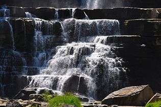
 Chittenango Falls' lower portion, as viewed from the bridge.
See also
References
- ↑ "Chittenango Falls State Park". NYS Office of Parks, Recreation & Historic Preservation. Retrieved April 9, 2016.
- 1 2 "Section O: Environmental Conservation and Recreation, Table O-9". 2014 New York State Statistical Yearbook (PDF). The Nelson A. Rockefeller Institute of Government. 2014. p. 671. Retrieved April 9, 2016.
- ↑ "Chittenango Falls State Park Brochure" (PDF). NYS Office of Parks, Recreation & Historic Preservation. Retrieved April 28, 2015.
- 1 2 "State Park Annual Attendance Figures by Facility: Beginning 2003". Data.ny.gov. Retrieved May 27, 2015.
- ↑ "Chittenango Falls State Park". Geographic Names Information System. United States Geological Survey. Retrieved April 28, 2015.
- 1 2 Breisch, Alvin; Niver, Robin (2006). "Chittenango Ovate Amber Snail (Novisuccinea chittenangoensis) Recovery Plan, First Revision" (PDF). Hadley, Massachusetts: U.S. Fish and Wildlife Service. Retrieved January 25, 2016.
- ↑ Doran, Elizabeth (January 9, 2014). "Chittenango Falls offers stunning views year-round". Syracuse.com. Retrieved April 28, 2015.
- This article incorporates public domain text (a public domain work of the United States Government) from reference.
External links
-
 Media related to Chittenango Falls State Park at Wikimedia Commons
 - New York State Parks: Chittenango Falls State Park
- Chittenango Falls State Park trail map