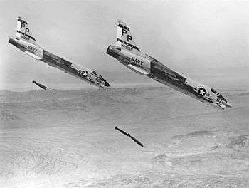
Chocolate Mountain Aerial Gunnery Range
Coordinates: 33°18′42″N 115°14′28″W / 33.31167°N 115.24111°W

The Chocolate Mountain Aerial Gunnery Range (CMAGR), is a 456,000 acre (1850 km²) Open-Area, approximately 20 miles wide, east to west, and 50 miles long, northwest to southeast, which is used by the Navy and Marines for aerial bombing and live fire aerial gunnery practice. It straddles the northern portion of the Chocolate Mountains to the east of the Salton Sea in Imperial and Riverside Counties, California, with restricted airspace in both California and Arizona.
It is under the jurisdiction of the United States Navy and United States Marine Corps, and is closed to the public.
The Bradshaw Trail, an old stage road and now a four wheel drive vehicle road, traverses the north boundary of the Gunnery Range.
References
- Profile on GlobalSecurity.org
- Final Legislative Environmental Impact Statement for the Renewal of the Chocolate Mountain Aerial Gunnery Range Land Withdrawal Naval Facilities Engineering Command Southwest
- U.S. Geological Survey Geographic Names Information System: Chocolate Mountain Aerial Gunnery Range

See also
| Wikimedia Commons has media related to Chocolate Mountain Aerial Gunnery Range. |

