Chodavaram (East)
| Chodavaram | |
|---|---|
| village | |
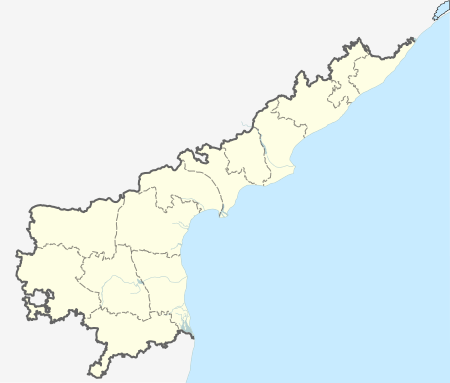 Chodavaram  Chodavaram Location in Andhra Pradesh, India | |
| Coordinates: 16°37′49″N 80°34′58″E / 16.63028°N 80.58278°ECoordinates: 16°37′49″N 80°34′58″E / 16.63028°N 80.58278°E | |
| Country |
|
| State | Andhra Pradesh |
| District | [West Godavari district] |
| Elevation | 26 m (85 ft) |
| Languages | |
| • Official | Telugu |
| Time zone | IST (UTC+5:30) |
| PIN | 534111 |
| Telephone code | 08818272--- |
| Lok Sabha constituency | Rajahmundry |
| Vidhan Sabha constituency | Gopalapuram |
Chodavaram (East) is a small village located in Nallajerla mandal of the West Godavari district of Andhra Pradesh, India. Chodavaram is located around 8 kilometers from the mandal headquarters, Nallajerla, and lies on the way from Anatapalli to Tadepalligudem town, which is 28 kilometers away. The village has 1,358 houses with a population of around 5,230. [1]
References
This article is issued from Wikipedia - version of the 8/27/2016. The text is available under the Creative Commons Attribution/Share Alike but additional terms may apply for the media files.