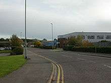
Christchurch Airfield
- For the World War II use of this facility, see RAF Christchurch
Christchurch Airfield was located southeast of the A337/B3059 intersection in Somerford, Christchurch, Dorset, England.
It was a civil airfield starting from 1926, then it was used during World War II by the Royal Air Force and the United States Army Air Forces Ninth Air Force. After the war the airfield returned to civilian use and the airfield complex was then demolished in 1966.
Before World War II
Flying at Christchurch started in July 1926 when Surrey Flying Services began offering five shilling pleasure flights from an area known as "Burrysfield". In May 1928, the Hampshire Aero Club operated from the area. The next step was when Francis C Fisher leased some open fields where he operated a flying facility in the summers until his lease ran out in 1932 by which time Fisher had flown over 19,000 passengers. In 1933 Sir Alan Cobhams Air Circus put on a show there attended by around 8,000 spectators.[1] In the same year, the Rambler Air Station was established and airline services commenced on 14 May 1934 with Western Airways operating a de Havilland Dragon Rapide and the airfield was known as Christchurch Airport. In February 1935 the airfield temporarily became known as Bournemouth Airport (not to be confused with Bournemouth Airport at Hurn).[2]
World War II
In World War II the airfield became RAF Christchurch. The Air Defence Research and Development Establishment was built at the northeastern end of the airfield, and in May 1940 the RAF Special Duties Flight, operating a very mixed bag of aircraft arrived to take part in the experiments with radar. The Airspeed factory was also built on part of the original airfield and began production of Horsa Mk I gliders, AS.10 Oxfords, and de Havilland Mosquitos for the RAF.
In 1943, the USAAF Ninth Air Force required several temporary advanced landing grounds along the southern English Channel coast prior to the Normandy invasion to provide tactical air support for the ground forces landing in France. Christchurch was provided to support this mission.
After the USAAF departure the airfield was returned to RAF control. In March 1945 control passed to RAF Transport Command. The main activities continued to be production (Mosquitos) by Airspeed, radar trials and glider pick-up training. In January 1946 control of the airfield passed to the Ministry of Aircraft Production.
After World War II

With the facility released from military control, civilian flying returned to Christchurch. The Christchurch Aero club operated from the north side while on the southwestern tip of the field the 622 Glider School operated for many years from a hangar just outside the airfield boundary.
In 1954 the Military Experimental Engineering Establishment from Christchurch laid a Tarmac runway on the site of the World War II wire and steel runway. The main beneficiaries of this exercise was the De Havilland factory which was producing Vampire, Venom, Sea Venom and Sea Vixen jet fighters and Airspeed Ambassador twin piston engined airliners.[3]
However, time was running out for Christchurch and following the closure of De Havilland factory in 1962, the use of the airfield rapidly declined. The manned air traffic control tower was closed in July 1963 and the Aero Club closed in 1964. The airfield officially closed at the end of 1964, although occasional aircraft used the airfield for several years after that date.
Today, Christchurch airfield has been developed by the urban areas of Somerford/Mudeford. The land which was the airfield is now a mix of housing and industry with nothing remaining of the airfield except some of the Airspeed buildings and streets named after aircraft.
References
- ↑ Stannard, Michael (1999). The Makers of Christchurch: A Thousand Year story. Natula Publications. pp. 226–228. ISBN 978-1-897887-22-6.
- ↑ White, Allen (1987) Christchurch Airfield - 40 Years Of Flying
- ↑ Stannard, Michael (1999). The Makers of Christchurch: A Thousand Year story. Natula Publications. p. 234. ISBN 978-1-897887-22-6.
Phipp, Mike (2006) 'Bournemouth's Airports - A History' (Tempus Publishing, Stroud, Gloucs, ISBN 0 7524 3923 5).
Coordinates: 50°44′08″N 1°44′43″W / 50.73546°N 1.74541°W