Cincinnati Skywalk

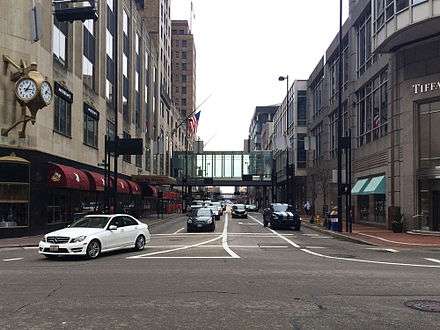
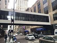
The Cincinnati Skywalk is a series of walkways, primarily indoors and elevated, which allows pedestrians to traverse downtown Cincinnati, Ohio.[1]
Built in segments starting in 1971, the 1.3-mile (2.1 km) skywalk was completed in 1997 at a total cost of more than $16 million.[1] Since then, some city leaders have begun to see the skywalk as a barrier to economic development, as it may decrease street-level and sidewalk pedestrian traffic.[2] Some segments of the skywalk have been removed and future demolitions are expected.[3]
As of March 2015, the skywalk exists as two disconnected segments: one from W. 6th St. near Central Ave. to an area near E. 5th St. and Walnut St., and another from Government Place and Walnut St. to the area of E. 4th St. near Sycamore.[3]
Creation

In 1957, Cincinnati Director of Planning Herbert W. Stevens introduced the idea of "elevated skywalks" as a way to keep pedestrians safe from cars driving through downtown.[1] The concept developed further in the 1960s as part of an urban renewal effort, hoping to make downtown easier to navigate and enjoy at a time when indoor, climate-controlled suburban shopping malls were growing in popularity.[2]
When the federal government agreed to provide urban renewal funds to help pay for the project, Cincinnati city's council decided to move forward with the skywalk. The first link opened in 1971, connecting the Cincinnati Convention Center to Fountain Square.[1]
More segments were added through the 1970s, 1980s,[1] and 1990s. It was officially finished in 1997 at a total cost of more than $16 million.[4]
Changing attitudes
Cincinnati's "2002 Center City Plan" emphasized downtown economic development, and stated the Skywalk allowed pedestrians to bypass the street and led people to believe downtown was abandoned. The report stated that increasing street-level pedestrian traffic would increase economic activity downtown.[3]
Safety and maintenance were also becoming a growing concern. As the skywalk was built, Cincinnati signed dozens of agreements with private property owners for upkeep, which made it confusing to determine who was responsible for making fixes and providing security.[1]

In 2005, then-mayor Charlie Luken told the New York Times the Skywalk is "ugly" and the space underneath is "yucky".[2]
Removing segments
In 2002, five years after it was considered complete, pieces of the skywalk started to come down. Crews tore out a segment connecting Riverfront Stadium to the Atrium I and II office buildings while configuring Fort Washington Way.
In 2005, as part of the redevelopment of Fountain Square, the city ripped out a segment from the Fifth Third Center to Vine Street and a pedestrian bridge over 5th Street.
In June 2008, a bridge segment over 5th Street between Elm and Race Streets was demolished. When the segment was first built, it connected Saks Fifth Avenue to an office tower on the north side of 5th Street. When the office tower was torn down, the skywalk bridge was no longer needed and removed.[5]
In 2012, the city removed an open-air segment of the skywalk over Elm St. and Rusconi Place.[3]
In January 2013, the bridge segment over Race Street between 5th and 6th Streets was removed. This bridge once connected Macy's to an office building on the west side of Race Street. The office building was demolished but the bridge remained intact for several years.[6] The construction of the new dunnhumby USA office building did not include the use of the skywalk bridge and the bridge was demolished.[3]
Maps

A research team at UrbanCincy.com has created this current map of the Cincinnati Skywalk using Google Maps, which it updates as sections are removed.[3] The map shows that as of March 2015, the skywalk exists in two isolated segments, separated by Fountain Square.
The Cincinnati Enquirer published this map of the skywalk in 2003, showing the skywalk as a fully connected system that stretched and wound from W. 6th St. near Central Ave., east and south to the area of E. 4th St. near Sycamore.[4]
References
- 1 2 3 4 5 6 "Downtown skywalk falls into disfavor". Cincinnati Enquirer. 1 June 2003.
- 1 2 3 "Rethinking Skyways and Tunnels". New York Times. 3 August 2005.
- 1 2 3 4 5 6 "The story behind Cincinnati's slowly disappearing skywalk system". Cincinnati Business Courier. 23 February 2012.
- 1 2 Mazzola, R. (1 June 2003). "The Skywalk". Enquirer.com. Cincinnati Enquirer. Retrieved 24 March 2015.
- ↑ ""Bridge to Nowhere" going away". Fox 19. June 2008.
- ↑ "Race Street closed as crews remove skywalk". WLWT. 12 Jan 2013.
Coordinates: 39°6′4″N 84°30′50″W / 39.10111°N 84.51389°W