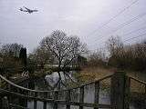
Colne Brook
River Colne (Hertfordshire) |
|---|
Legend
|
|
|
Colne source: subterranean river in North Mymms Park |
|
|
|
Colney Heath |
|
|
|
River Ver, river of Redbourn and St Albans |
|
|
|
Weir |
|
|
|
Weir |
|
|
|
Watford — on opposite bank: Oxhey |
|
|
|
Weir |
|
|
|
Weir |
|
|
|
River Gade, river of Hemel Hempstead and distributary of the Bulbourne |
|
|
|
Grand Union Canal towards Rugby, Coventry, Leicester or Birmingham |
|
|
|
side weir |
|
|
|
|
|
|
|
River Chess, river of Chesham, Chenies and Sarratt |
|
|
|
Rickmansworth (east of) |
|
|
|
|
|
|
|
Batchworth Locks |
|
|
|
Town Ditch, Rickmansworth |
|
|
|
A404 Riverside Drive/Church Street |
|
|
|
|
|
|
|
|
|
|
|
|
|
|
|
|
|
|
|
|
|
|
|
Short navigable branch of river |
|
|
|
|
|
|
|
Troy Cut of the Grand Union Canal |
|
|
|
|
|
|
|
|
|
|
|
Railway bridge — Chiltern Main Line |
|
|
|
Frays River |
|
|
|
|
|
|
|
River Misbournebisects: |
|
|
|
A40 road |
|
|
|
A4020 |
|
|
|
Shire Ditch, Uxbridge/ Uxbridge Park (offices), Denham |
|
|
|
|
|
|
|
Uxbridge |
|
|
|
A4007 |
|
|
|
Alder Bourne from Fulmer |
|
|
|
|
|
|
|
M25 Motorway |
|
|
|
Colne Brook |
|
|
|
M25 motorway |
|
|
|
Slough Arm |
|
|
|
River Pinn bisects Pinner, Ruislip and Ickenham |
|
|
|
Grand Union Canal towards London |
|
|
|
Great Western Main Line |
|
|
|
M25 Motorway |
|
|
|
River Colne |
|
|
|
M4 motorway |
|
|
|
Bigley Ditch |
|
|
|
|
|
|
|
A4 Colnbrook Bypass |
|
|
|
M25 Motorway |
|
|
|
Poyle Channel |
|
|
|
Duke of Northumberland's River to Isleworth or Twickenham |
|
|
|
Longford River to Hampton Court |
|
|
|
A3044 Stanwell Moor |
|
|
|
M25 Junction 14 T5 Slip Road |
|
|
|
A3044 Stanwell Moor |
|
|
|
A3113 Airport Way |
|
|
|
M25 motorway |
|
|
|
|
|
|
|
River Wraysbury |
|
|
|
Bonehead Ditch |
|
|
|
Colne Brook |
|
|
|
Railway bridges — |
|
|
|
A30 Staines Bypass |
|
|
|
River Ash to Sunbury-on-Thames |
|
|
|
Railway bridge |
|
|
|
|
|
|
|
Church Street, Staines-upon-Thames |
|
|
|
A308 Clarence Street |
|
|
|
River Thames |
|
The Colne Brook is a river in England that is a distributary of the River Colne which runs from Uxbridge Moor, there forming the western border of Greater London, to the River Thames just below Bell Weir Lock in Hythe End, Wraysbury, Berkshire.[n 1]
Detailed Course
On leaving the Colne at Uxbridge Moor in the Colne Valley regional park, the Colne Brook flows close by to the west until West Drayton then passes under the M25 motorway at the M4 "Thorney interchange", enters Berkshire and flows through the village of Colnbrook. South of Colnbrook it receives a proportion of water from the Poyle Channel — after which the remainder of the Poyle Channel becomes the Wraysbury River — then the Brook runs between Horton's centre and another residential part of Horton on Coppermill Road adjoining Wraysbury Reservoir. Colne Brook then enters the Royal Borough of Windsor and Maidenhead, passes Wraysbury railway station then adjoins lakes made of former gravel pit at Wraysbury which make up a Site of Special Scientific Interest, before running into the River Thames between the M25 Runnymede Bridge and nearby Bell Weir Lock.[1]
See also
Notes and References
- Notes
- References
|
|---|
|
| Non-tributaries | |
|---|
|
| Tributaries | |
|---|
|
| Passing Denham/Iver | |
|---|
|
| Man-made | |
|---|
Coordinates: 51°26′19″N 0°32′06″W / 51.43861°N 0.53500°W / 51.43861; -0.53500
