Colorado State Highway 52
| ||||
|---|---|---|---|---|
|
Map of northern Colorado with SH 52 highlighted in red | ||||
| Route information | ||||
| Maintained by CDOT | ||||
| Length: | 111.01 mi[1] (178.65 km) | |||
| Major junctions | ||||
| West end: |
| |||
| East end: |
| |||
| Location | ||||
| Counties: | Boulder, Weld, Morgan | |||
| Highway system | ||||
|
Colorado State Highways
| ||||


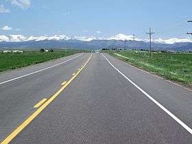
Snowcapped peaks of the Continental divide as seen from SH 52
State Highway 52 (SH 52) is a 111 mi (178.6 km)a[›] long state highway in northeastern Colorado.
Route description
SH 52 begins near Niwot, running east from its western terminus past US 287 to a diamond interchange with I-25, near the towns of Dacono, Frederick, and Firestone. The highway continues east through interchanges with US 85 in Fort Lupton and I-76 in Hudson. Farther east, the route bends north about 12 miles (19 km) south of Wiggins where it begins its concurrency with I-76, US 6, and US 34 eastward to Fort Morgan where it again turns north and traverses to Raymer, where it ends at SH 14.
Junction list
| County | Location | mi[2] | km | Destinations | Notes |
|---|---|---|---|---|---|
| Boulder | | 0 | 0.0 | Western terminus | |
| | 4.5 | 7.2 | |||
| Weld | | 11 | 18 | Interchange | |
| Fort Lupton | 20 | 32 | Interchange | ||
| Hudson | 29 | 47 | Interchange | ||
| | 41.5 | 66.8 | |||
| Morgan | | 72.5 | 116.7 | West end of I-76/US 34/US 6 overlap | |
| | 82 | 132 | East end of I-76/US 6 overlap; West end of I-76 Bus. overlap; Interchange | ||
| Fort Morgan | 86 | 138 | East end of US 34/I-76 Bus. overlap | ||
| 86.5 | 139.2 | ||||
| 87 | 140 | Interchange | |||
| Weld | Raymer | 111 | 179 | Eastern terminus | |
1.000 mi = 1.609 km; 1.000 km = 0.621 mi
| |||||
References
- ↑ "Segment list for SH 52". Retrieved 2007-05-12.
- ↑ Colorado Department of Transportation, Highway Data, accessed December 2007: note that not every interval between mileposts is exactly a mile, explaining why more junctions than expected are at the exact milepost
External links
This article is issued from Wikipedia - version of the 2/5/2016. The text is available under the Creative Commons Attribution/Share Alike but additional terms may apply for the media files.