Dún Laoghaire–Rathdown
| Dún Laoghaire–Rathdown Dún Laoghaire–Ráth an Dúin | ||
|---|---|---|
| County | ||
| ||
|
Motto: Ó Chuan go Sliabh (Irish) "From Harbour to Mountain" | ||
 | ||
| Country | Ireland | |
| Province | Leinster | |
| Dáil Éireann |
Dún Laoghaire, Dublin Rathdown | |
| EU Parliament | Dublin | |
| County town | Dún Laoghaire | |
| Government | ||
| • Type | County Council | |
| Area | ||
| • Total | 127.31 km2 (49.15 sq mi) | |
| Population (2016) | 217,274 | |
| Vehicle index mark code | D | |
| Website |
www | |
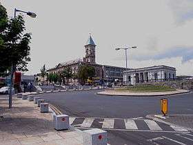
Dún Laoghaire–Rathdown[1] (Irish: Dún Laoghaire–Ráth an Dúin) is a county in Ireland. It is part of the Dublin Region in the province of Leinster. It is named after the former borough of Dún Laoghaire and the barony of Rathdown. Dún Laoghaire-Rathdown County Council is the local authority for the county. The population of the county is 217,274 according to the 2016 census.[2]
Geography and political subdivisions
Dún Laoghaire–Rathdown is bordered to the east by the Irish Sea, to the north by the local government area of Dublin City Council, to the west by the county of South Dublin and to the south by County Wicklow. University College Dublin and Dún Laoghaire Institute of Art, Design and Technology are located in the county. It is one of four entities that comprise the "Dublin Region": the three smaller counties into which County Dublin was divided in 1994, which along with the city of Dublin. Located to the south-east of the capital city of Dublin, the county town of Dún Laoghaire–Rathdown is Dún Laoghaire. It was created in 1994 by merging the areas under the jurisdiction of the Corporation of Dún Laoghaire and the south-eastern part of the former Dublin County Council. Additionally, the powers of the former Deansgrange Joint Burial Board were subsumed into the new authority. Since 2015, the county lies within the Eastern & Midland Regional Authority, one of three such subdivisions of the state.
Towns, villages and suburbs
- Ballinteer
- Ballybrack
- Blackrock
- Booterstown
- Belfield
- Bray
- Cabinteely
- Carrickmines
- Cherrywood
- Churchtown
- Clonskeagh
- Dalkey
- Deansgrange
- Dundrum
- Dún Laoghaire
- Foxrock
- Goatstown
- Glasthule
- Glenageary
- Glencullen
- Johnstown
- Killiney
- Kilmacud
- Kilternan
- Leopardstown
- Loughlinstown
- Monkstown
- Mount Merrion
- Rathfarnham
- Sandyford
- Sandycove
- Sallynoggin
- Shankill
- Stepaside
- Stillorgan
- Ticknock
Terminology and etymology
The name Rathdown is an anglicisation of the Irish "Ráth an Dúin", meaning "ringfort of the fort". Dún Laoghaire, means "Laoghaire's fort".
In Ireland the word "County" has traditionally come before rather than after the county's name: thus "County Clare" in Ireland as opposed to "Clare County" in Michigan, US. However, the counties created after 1994 often drop the word "County" entirely or use it after the name: for example, internet search engines show many more uses on Irish sites of "Dún Laoghaire–Rathdown" than of either "County Dún Laoghaire–Rathdown" or "Dún Laoghaire–Rathdown County". There appears to be no official guidance on the matter and the local authority uses all three forms.[3]
There is no "Rathdown" town in the county. The modern county follows virtually the same divisions as the medieval half-barony of Rathdown, a subdivision of County Dublin.
While it is the smallest county in Ireland in terms of area, it is also the county with the longest name. Furthermore, the official legal name of the county, in English, is spelt without a síneadh fada on the "u" in the Irish-language part of the name, "Dún Laoghaire"[4] (although the current style within the county council is to use the síneadh fada on the name in both Irish and English).[5] The reason for this is that the titles of the new Dublin county councils were never examined at committee stage in the Houses of the Oireachtas, and were last altered under the 1991 Local Government Act which was rushed into effect. Both parliamentary debates and Dublin County Council’s own reorganisation report published in 1992 concluded that the name Dun Laoghaire-Rathdown was "unacceptable". A one-year proviso contained in the 1993 Local Government (Dublin) Act for changing the name of the county at local level was allowed to expire by the new council. The legislation permits the elected members of the council to make representations for additional legislation altering the name of the county.
County insignia
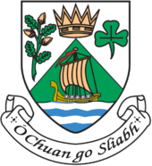
The motto on the insignia of the County Council reads, Ó Chuan go Sliabh, Irish for "From Harbour to Mountain". The crown in the device is that of King Lóegaire mac Néill (Laoghaire, the High King of Ireland in the fifth century, who resided in the area).
Local government and politics

Dún Laoghaire–Rathdown County Council is the local authority for the county. There are six Local Electoral Areas (LEAs) for the county which return a total of 40 councillors as follows: Killiney-Shankill (6), Blackrock (6), Dundrum (7), Dún Laoghaire (8), "Glencullen/Sandyford" (7), Stillorgan (6).
In 1986, the "administrative county" of Dublin was divided into three "electoral counties": Dún Laoghaire-Rathdown, Dublin — Fingal, and Dublin — Belgard.[6] In 1994, Dublin County Council and the Corporation of Dún Laoghaire were abolished and the three electoral counties became "administrative counties", named Dun Laoghaire-Rathdown, Fingal, and South Dublin respectively.[7] In 2001, the "administrative counties" were redesignated as simply "counties". The three counties together with Dublin city constitute the Dublin Region. The label "County Dublin" continues to be used informally for this area (the city has been administered separately from County Dublin since 1548).
For elections to Dáil Éireann, the county is split between the constituencies of Dún Laoghaire (4 representatives) and Dublin Rathdown (3 representatives), with the division generally running along the N11. These constituencies currently have four Fine Gael TDs, one Green Party TD, one Anti-Austerity Alliance–People Before Profit TD and one Independent TD.
The Dublin region forms the Dublin constituency in European Parliament elections.
Transport
The Dublin Area Rapid Transit system runs through the eastern coast of the county and connects to Dublin city centre to the north as well as other points north and south on the Iarnród Éireann railway system, with connections to Intercity trains. The green Luas line runs through the centre of the county.
There is a medium-sized harbour at Dún Laoghaire, with now discontinued ferry crossings to and from Holyhead in North Wales; this was a popular route for tourists travelling across the Irish Sea from Britain. This service was suspended indefinitely in September 2014.
Footnotes
- ↑ Electoral Amendment Act 2009 – Schedule
- ↑ Census 2011 – County Dun Laoghaire-Rathdown Overview
- ↑ Fingal County Council website, where (apart from references to the Council itself) both "Fingal County" and "County Fingal" appear, but much less frequently than "Fingal" alone.
- ↑ Local Government (Dublin) Act, 1993 - Section 9 (2c)
- ↑ DLRcoco.ie
- ↑ "Local Government (Reorganisation) Act, 1985, Section 12". Irish Statute Book. Retrieved 14 February 2014.
"S.I. No. 400/1993 - Local Government (Dublin) Act, 1993 Commencement Order, 1993.". Irish Statute Book. Retrieved 14 February 2014. - ↑ "S.I. No. 400/1993 - Local Government (Dublin) Act, 1993 Commencement Order, 1993.". Irish Statute Book. Retrieved 14 February 2014.
"Local Government (Dublin) Act, 1993". Irish Statute Book. Retrieved 14 February 2014.
External links
| Wikimedia Commons has media related to County of Dun Laoghaire-Rathdown. |
- Dún Laoghaire-Rathdown County Council
- Dún Laoghaire-Rathdown County Enterprise Board
- Dún Laoghaire-Rathdown Tourism
Coordinates: 53°18′00″N 6°08′24″W / 53.30000°N 6.14000°W

