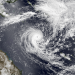
1982–83 Australian region cyclone season
1982–83 Australian region cyclone season
| |
| Season summary map |
| First system formed |
2 January 1983 |
| Last system dissipated |
2 May 1983 |
| Strongest storm1 |
Elinor – 935 hPa (mbar), 185 km/h (115 mph) (10-minute sustained) |
| Tropical lows |
7 |
| Tropical cyclones |
7 |
| Severe tropical cyclones |
5 |
| Total fatalities |
Unknown |
| Total damage |
Unknown |
| 1Strongest storm is determined by lowest pressure |
Australian region tropical cyclone seasons
1980–81, 1981–82, 1982–83, 1983–84, 1984–85 |
| Related articles |
|
|
The 1982–83 Australian region cyclone season was an inactive one. It officially started on 1 November 1982, and officially ended on 30 April 1983.
Storms
Severe Tropical Cyclone Jane
| Category 4 severe tropical cyclone (Australian scale) |
| Category 1 tropical cyclone (SSHWS) |
|
|
| Duration |
2 January – 10 January |
| Peak intensity |
170 km/h (105 mph) (10-min) 947 hPa (mbar) |
Jane formed on January 2, 1983 near Indonesia. The storm moved southward where it reached Category 1 status on the same day. Jane did a small loop before continuing south-eastward. Jane reached Category 4 status before making landfall east of Port Hedland, Western Australia. Jane then dissipated after January 10.[1]
Tropical Cyclone Des
| Category 2 tropical cyclone (Australian scale) |
| Tropical storm (SSHWS) |
|
|
| Duration |
14 January – 23 January |
| Peak intensity |
100 km/h (65 mph) (10-min) 994 hPa (mbar) |
A tropical depression developed within a monsoon trough east-northeast of Cairns, Queensland, on 14 January. Des moved east-southeastward and strengthened gradually. Later, the storm tracked generally northward, until curving eastward and dissipating on 23 January.
Severe Tropical Cyclone Elinor
| Category 4 severe tropical cyclone (Australian scale) |
| Category 3 tropical cyclone (SSHWS) |
|
|
| Duration |
10 February – 4 March |
| Peak intensity |
185 km/h (115 mph) (10-min) 935 hPa (mbar) |
In March 1983, Cyclone Elinor made landfall in Queensland, wrecking two yachts.[2]
Severe Tropical Cyclone Ken
| Category 3 severe tropical cyclone (Australian scale) |
| Tropical storm (SSHWS) |
|
|
| Duration |
28 February – 6 March |
| Peak intensity |
130 km/h (80 mph) (10-min) 970 hPa (mbar) |
Ken formed on February 28, 1983 several hundred miles north of Australia. The storm briefly reached Category 3 status before making landfall in the sparsely populated area. The storm dissipated well inland by March 6.[3]
Tropical Cyclone Lena
| Category 2 tropical cyclone (Australian scale) |
| Category 1 tropical cyclone (SSHWS) |
|
|
| Duration |
2 April – 9 April |
| Peak intensity |
110 km/h (70 mph) (10-min) 980 hPa (mbar) |
Lena formed off the coast of Indonesia on April 3, 1983. The storm reached Category 2 status before making landfall at Port Hedland, Australia. The storm dissipated on April 9.
Severe Tropical Cyclone Naomi
| Category 3 severe tropical cyclone (Australian scale) |
| Category 2 tropical cyclone (SSHWS) |
|
|
| Duration |
21 April – 2 May |
| Peak intensity |
150 km/h (90 mph) (10-min) 960 hPa (mbar) |
A tropical low developed near the western edge of the Australia region basin on 21 April. After strengthening into Cyclone Naomi, the system headed southeastward for much of its duration. By 30 April, Naomi doubled-back and moved northwestward, but dissipated on 2 May.
Severe Tropical Cyclone Monty
| Category 3 severe tropical cyclone (Australian scale) |
| Tropical storm (SSHWS) |
|
|
| Duration |
22 April – 29 April |
| Peak intensity |
120 km/h (75 mph) (10-min) 975 hPa (mbar) |
The final cyclone of the season, Monty, developed from a weak tropical low on 22 April. Moving generally southward, Monty dissipated on 29 April.
See also
- Atlantic hurricane seasons: 1982, 1983,
- Eastern Pacific hurricane seasons: 1982, 1983
- Western Pacific typhoon seasons: 1982, 1983
- North Indian Ocean cyclone seasons: 1982, 1983
References


