D34 road (Croatia)
| |
|---|---|
| Route information | |
| Length: | 79.0 km (49.1 mi) |
| Major junctions | |
| From: |
|
|
| |
| To: |
|
| Location | |
| Counties: | Virovitica-Podravina, Osijek-Baranja |
| Major cities: | Slatina, Donji Miholjac, Belišće, Valpovo, Osijek |
| Highway system | |
| State roads in Croatia | |

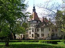
Donji Miholjac, on the D34 road route
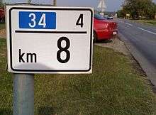
A D34 road mile marker
D34 is a state road in Slavonia region of Croatia connecting the cities of Slatina, Donji Miholjac, Valpovo and Osijek.[maps 1] The road is 79 km (49 mi) long.[1]
The road, as well as all other state roads in Croatia, is managed and maintained by Hrvatske ceste, state owned company.[2]
Traffic volume
Traffic is regularly counted and reported by Hrvatske ceste, operator of the road.[3]
| D34 traffic volume | ||||
| Road | Counting site | AADT | ASDT | Notes |
| |
2411 Podravska Moslavina | 1,986 | 2,022 | Between the Ž4030 and Ž4031 junctions. |
| |
2402 Donji Miholjac - east | 3,463 | 3,729 | Adjacent to the D53 junction. |
| |
2405 Šag | 5,237 | 4,949 | Adjacent to the Ž4051 junction. |
Road junctions and populated areas
| D34 junctions/populated areas | |
| Type | Slip roads/Notes |
| |
Slatina The western terminus of the road. |
| |
Medinci |
| |
Ž4026 to Nova Šarovka. |
| |
Novi Senkovac |
| |
Šaševo |
| |
Čađavica Ž4038 to Mikleuš and Četekovac. Ž4024 to Noskovci, Sopje, Vaška and Suhopolje (D2). |
| |
Čađavački Lug |
| |
Gezinci |
| |
Podravska Moslavina Ž4030 to Moslavački Krčenik, Zdenci, Orahovica, Kutjevo and Pleternica (D38). |
| |
Viljevo Ž4031 to Šljivoševci and Koška (D2). |
| |
Donji Miholjac Ž4032 to Ivanovo. The D34 and D53 roads are concurrent to the south of the junction. Ž4295 within the town. |
| |
The D34 and D53 roads are concurrent to the north of the junction. |
| |
Sveti Đurađ |
| |
Podgajci Podravski |
| |
Črnkovci Ž4047 to Čamagajevci and Miholjački Poreč (D53). Ž4049 to Marijanci and Šljivoševci. |
| |
Veliškovci |
| |
Valpovo Ž4051 within the city. Ž4052 to Koška (D2). Ž4059 to Bocanjevci. |
| |
Šag |
| |
Petrijevci Ž4061 to Ladimirevci. |
| |
Ž4068 to Josipovac, Višnjevac and Osijek. |
| |
The interchange marks the western extent of Osijek bypass. The eastern terminus of the road. |
Maps
- ↑ Overview map of the D34 (Map). OpenStreetMap. Retrieved July 26, 2014.
Sources
- ↑ Ministry of Sea, Transport and Infrastructure (Croatia) (June 4, 2013). "Decision on categorization of public roads" (in Croatian). Narodne novine. Retrieved July 26, 2014.
- ↑ "Public Roads Act". Narodne novine (in Croatian). December 14, 2004.
- ↑ "Traffic counting on the roadways of Croatia in 2009 - digest" (PDF). Hrvatske ceste. May 1, 2010. Archived from the original (PDF) on July 21, 2011.
- ↑ "Map of border crossings and customs office areas" (PDF). Customs Administration of the Republic of Croatia (in Croatian). March 6, 2008.
- ↑ "Regulation on motorway markings, chainage, interchange/exit/rest area numbers and names". Narodne novine (in Croatian). May 6, 2003.
This article is issued from Wikipedia - version of the 9/13/2016. The text is available under the Creative Commons Attribution/Share Alike but additional terms may apply for the media files.