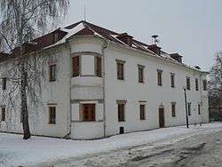
Dlouhá Loučka (Olomouc District)
| Dlouhá Loučka | |||
|---|---|---|---|
| Municipality | |||
 | |||
| |||
 Dlouhá Loučka | |||
| Coordinates: 49°49′19″N 17°11′30″E / 49.82194°N 17.19167°ECoordinates: 49°49′19″N 17°11′30″E / 49.82194°N 17.19167°E | |||
| Country |
| ||
| Region | Olomouc | ||
| District | Olomouc | ||
| Area | |||
| • Total | 26.57 km2 (10.26 sq mi) | ||
| Elevation | 398 m (1,306 ft) | ||
| Population (2006) | |||
| • Total | 1,816 | ||
| • Density | 68/km2 (180/sq mi) | ||
| Postal code | 783 86 | ||
| Website | http://www.dlouhaloucka.cz | ||

_CoA_CZ.jpg)
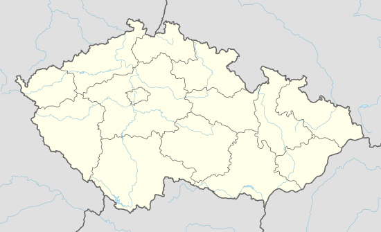
Dlouhá Loučka (German Langendorf) is a village and municipality (obec) in Olomouc District in the Olomouc Region of the Czech Republic.
The municipality covers an area of 26.57 square kilometres (10.26 sq mi), and has a population of 1,816 (as at 3 July 2006).
Dlouhá Loučka lies approximately 26 kilometres (16 mi) north of Olomouc and 201 km (125 mi) east of Prague.
References
| Wikimedia Commons has media related to Dlouhá Loučka (Olomouc District). |
This article is issued from Wikipedia - version of the 4/7/2016. The text is available under the Creative Commons Attribution/Share Alike but additional terms may apply for the media files.