Dona Ana Bridge
| Dona Ana Bridge Ponte Dona Ana | |
|---|---|
 | |
| Coordinates | 17°26′21″S 35°03′41″E / 17.43917°S 35.06139°ECoordinates: 17°26′21″S 35°03′41″E / 17.43917°S 35.06139°E |
| Carries | Sena railway |
| Crosses | Zambezi River |
| Locale | Vila de Sena and Mutarara in Mozambique |
| Preceded by | Samora Machel Bridge |
| Followed by | Armando Emilio Guebuza Bridge |
| Characteristics | |
| Total length | 3,670 metres (12,040 ft) |
| Number of spans | 40 |
| History | |
| Designer | Edgar Cardoso |
| Construction end | 1934 |
 Dona Ana Bridge Location in Mozambique | |
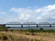
The Dona Ana Bridge spans the lower Zambezi River between the towns of Vila de Sena and Mutarara in Mozambique, effectively linking the two halves of the country. It was originally constructed as a railway bridge to link Malawi and the Moatize coal fields to the port of Beira.
History
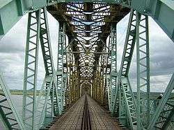
The 3.67 kilometres (2.28 mi) long Dona Ana Bridge was at that time the longest railway bridge in Africa. The bridge comprises 33 spans of 80m and 7 spans of 50m.[1] Built by the Portuguese in 1934 during the Portuguese rule of Mozambique, it was rendered unusable in the 1980s, during the Mozambican Civil War.[2]
The USAID assisted with the repairs and it was converted to a single-lane bridge for vehicle traffic.[3]
Although not located on a primary highway, it provided an alternative route over the Zambezi. The other two options were the bridge at Tete and the former road ferry at Caia which was not always reliable. The Dona Ana Bridge is the longest bridge across the Zambezi and it used to be the last downstream bridge before the construction of the Armando Emilio Guebuza Bridge in 2009.
The bridge was completely closed to vehicular traffic in October 2006 for rehabilitation and re-conversion to a rail bridge and was reopenned as a rail bridge in 2009.
Gallery

.jpg) Destroyed by flood waters, 2000
Destroyed by flood waters, 2000 Archives
See also
References
- ↑ RailwaysAfrica May 2009, p10
- ↑ Little Miss Moffat, http://www.travelafricamag.com - Travel Africa Magazine (7 April, 2009)
- ↑ "1995: Rebuilding Bridges". USAID. 1999. Retrieved 8 March 2013.