Dryden, Virginia
| Dryden, Virginia | |
|---|---|
| CDP | |
| Nickname(s): Yokum Station | |
|
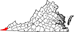
Location of Dryden, Virginia | |
| Coordinates: 36°46′33″N 82°56′39″W / 36.77583°N 82.94417°WCoordinates: 36°46′33″N 82°56′39″W / 36.77583°N 82.94417°W | |
| Country | United States |
| State | Virginia |
| County | Lee |
| Area | |
| • Total | 7.1 sq mi (18.5 km2) |
| • Land | 7.1 sq mi (18.5 km2) |
| • Water | 0.0 sq mi (0.0 km2) |
| Elevation | 1,440 ft (439 m) |
| Population (2010) | |
| • Total | 1,208 |
| • Density | 170/sq mi (65/km2) |
| Time zone | Eastern (EST) (UTC-5) |
| • Summer (DST) | EDT (UTC-4) |
| ZIP code | 24243 |
| Area code(s) | 276 |
| FIPS code | 51-23584[1] |
| GNIS feature ID | 1483150[2] |
Dryden is a census-designated place (CDP) in Lee County, Virginia, United States. The population was 1,208 at the 2010 census.
History
The Dryden post office was established in 1879.[3] The community was named for Captain Dryden, a railroad official.[4]
Geography
Dryden is located at 36°46′33″N 82°56′39″W / 36.77583°N 82.94417°W (36.775836, -82.944157).[5]
Dryden's southern border is the Powell River.
Notable residents
C. Bascom Slemp presidential secretary to President Calvin Coolidge,
Vincent Hobbs killed Chief Benge during an Indian raid near Norton, Virginia, Father of Captain Samuel Hobbs of 64 VA mounted infantry. CSA
Pete DeBusk founder of DeRoyal Company,
Jim Pankovits Pro Baseball player, grandson of Meda Parsons Smalley (1909-2009) who lived to be 101,
Demographics
As of the census[1] of 2000, there were 1,253 people, 453 households, and 329 families residing in the CDP. The population density was 175.9 people per square mile (67.9/km²). There were 507 housing units at an average density of 71.2/sq mi (27.5/km²). The racial makeup of the CDP was 98.64% White, 0.72% African American, 0.32% Native American, 0.24% Asian, and 0.08% from two or more races. Hispanic or Latino of any race were 0.16% of the population.
There were 453 households out of which 33.6% had children under the age of 18 living with them, 54.7% were married couples living together, 14.3% had a female householder with no husband present, and 27.2% were non-families. 24.9% of all households were made up of individuals and 11.7% had someone living alone who was 65 years of age or older. The average household size was 2.49 and the average family size was 2.96.
In the CDP the population was spread out with 22.9% under the age of 18, 8.3% from 18 to 24, 27.4% from 25 to 44, 25.5% from 45 to 64, and 16.0% who were 65 years of age or older. The median age was 39 years. For every 100 females there were 90.4 males. For every 100 females age 18 and over, there were 87.2 males.
The median income for a household in the CDP was $21,023, and the median income for a family was $25,806. Males had a median income of $26,250 versus $20,250 for females. The per capita income for the CDP was $12,825. About 17.8% of families and 22.3% of the population were below the poverty line, including 32.7% of those under age 18 and 10.8% of those age 65 or over.
References
- 1 2 "American FactFinder". United States Census Bureau. Retrieved 2008-01-31.
- ↑ "US Board on Geographic Names". United States Geological Survey. 2007-10-25. Retrieved 2008-01-31.
- ↑ "Lee County". Jim Forte Postal History. Retrieved 30 September 2014.
- ↑ Tennis, Joe (2004). Southwest Virginia Crossroads: An Almanac of Place Names and Places to See. The Overmountain Press. p. 14. ISBN 978-1-57072-256-1.
- ↑ "US Gazetteer files: 2010, 2000, and 1990". United States Census Bureau. 2011-02-12. Retrieved 2011-04-23.
