Eastern Bosphorus
Coordinates: 43°04′N 131°54′E / 43.067°N 131.900°E
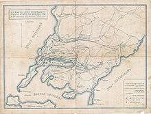
Map of Vladivostok from 1918
Russky Bridge under construction

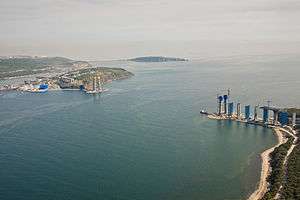
Russky Bridge
Eastern Bosporus (or Eastern Bosphorus, Russian: Босфор Восточный, Bosfor Vostochny) is a strait that separates the Muravyov-Amursky Peninsula and Russky Island, and connects Amur Bay and Ussuri Bay.
The depth is up to 50 m. It is about 9 km long and only 800 m wide at its narrowest point. Completed in July 2012, Russky Bridge, a cable-stayed bridge connects Russky Island and mainland Vladivostok. As of 2013, the bridge is the longest cable-stayed bridge in the world by virtue of its span of 1104 m.
| Wikimedia Commons has media related to Eastern Bosphorus. |
See also
This article is issued from Wikipedia - version of the 2/26/2015. The text is available under the Creative Commons Attribution/Share Alike but additional terms may apply for the media files.