Embleton Bay


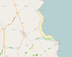
Embleton Bay is a bay on the North Sea, located to the east of the village of Embleton, Northumberland, England. It lies just to the south of Newton-by-the-Sea and north of Craster. Popular for paddling,[1] it is overlooked by the ruins of Dunstanburgh Castle and by Dunstanburgh Castle Golf Club.[2]
Geography

The beach has a whinstone reefs and the sand is a ruddy gold color. At its southern end, a castle is situated on a black cliff promontory. A little trout stream, known as the Embleton Burn, begins in the inland moors, makes its way through an area of the old barony, woody denes, and channels, before reaching the centre of the bay.[3] The coast from Newton Seahouses to Dunstanburgh Point is made up of sandhills. Located on the North Sea, the bay is a good stopping place in offshore winds, and is formed by the points known as Out Car and Emblestone to the north, and Dunstanburgh Point to the south.
The anchorage is in 6 to 8 fathoms (11 to 15 m). There is good holding ground, with Heifer Bank Tower and trees in line with Dunstanstead, at a bearing of 232°; and Beadnell Church Spire, open to the east of Newton Point, at a bearing of 335°.[4] There is a dramatic boulder field.[5]
History

In the 1830s, a sandstone rock was discovered near the low tide mark on the Embleton sea shore. Carved on the rock in Roman capitals were the words, "ANDRA BARTON".[6] "Andra", or Sir "Andrew" Barton, a Scottish sea captain and "fearless freebooter",[7] was a mariner in James IV, King of Scots' navy.[3]
Flora and fauna
Flora in the dunes area include bloody crane's-bill, potentilla, eye bright, bedstraw, spring squill, wild thyme, and wild vetch, .[3] Some of the bay's cliffs are a seabird site frequented by breeding eider ducks, fulmars, kittiwake, and shags.[8] There is an occurrence of Atelecyclus rotundatus within the bay.[9]
References
-
 This article incorporates text from a work in the public domain: A. G. Bradley's The Romance of Northumberland (1908).
 -
 This article incorporates text from a work in the public domain: United States Hydrographic Office's British Islands Pilot (1915).
 -
 This article incorporates text from a work in the public domain: G. Tate's The History of the Borough, Castle, and Barony of Alnwick (1866).
 -
 This article incorporates text from a work in the public domain: Berwickshire Naturalists' Club's History of the Berwickshire Naturalists' Club, instituted September 22, 1831 (1857).
- ↑ "Embleton and Newton Links On the Northumberland Coast, north east of Alnwick". National Trust. 2011. Retrieved 24 October 2011.
- ↑ "Embleton Bay, Northumberland". The Daily Telegraph. July 1, 2011. Retrieved 24 October 2011.
- 1 2 3 Bradley, Arthur Granville (1908). The romance of Northumberland (Public domain ed.). Methuen and co. pp. 45–. Retrieved 23 October 2011.
- ↑ United States. Hydrographic Office (1915). British Islands pilot (Public domain ed.). Govt. print. off. pp. 151–. Retrieved 23 October 2011.
- ↑ Frost, Lee (17 July 2007). Lee Frost's Landscape Photography. David & Charles. pp. 42–. ISBN 978-0-7153-2564-3. Retrieved 29 October 2011.
- ↑ Tate, George (1866). The history of the borough, castle, and barony of Alnwick (Public domain ed.). H.H. Blair. pp. 204–. Retrieved 25 October 2011.
- ↑ Terry, Jean F. (25 September 2006). Northumberland Yesterday and Today. Echo Library. pp. 14–. ISBN 978-1-4068-0851-3. Retrieved 25 October 2011.
- ↑ Walters, Martin; Gibbons, Bob (April 2003). Britain. Oxford University Press. pp. 79–. ISBN 978-0-19-850433-7. Retrieved 29 October 2011.
- ↑ Berwickshire Naturalists' Club (Scotland). (1857). History of the Berwickshire Naturalists' Club, instituted September 22, 1831. The Club. pp. 130–. Retrieved 29 October 2011.
Coordinates: 55°29′24″N 1°35′41″W / 55.490048°N 1.594676°W