Erdemli
| Erdemli | |
|---|---|
 Erdemli | |
| Coordinates: TR 36°36′28″N 34°15′58″E / 36.60778°N 34.26611°ECoordinates: TR 36°36′28″N 34°15′58″E / 36.60778°N 34.26611°E | |
| Country |
|
| Province | Mersin |
| Government | |
| • Mayor | Mükerrem Tollu (MHP) |
| • Kaymakam | İbrahim Özefe |
| Area[1] | |
| • District | 2,038.87 km2 (787.21 sq mi) |
| Population (2012)[2] | |
| • Urban | 50,154 |
| • District | 129,044 |
| • District density | 63/km2 (160/sq mi) |
| Post code | 33xxx |
| Website |
www |
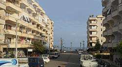
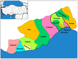
Erdemli is a town and district of Mersin Province in the Mediterranean region of Turkey, 35 km (22 mi) west of the city of Mersin.
Geography
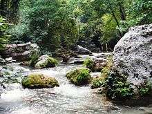
The district extends from the Mediterranean coastal plain, the largest agricultural area in Mersin Province, to high in the Taurus Mountains where there is forest, and then a large area (half the land area of the district) is high mountain above the treeline.
Erdemli is a quiet rural district where the people are conservative, and is traditionally a stronghold of Turkish nationalist politicians; however some departments of Mersin University are opening branches here which will surely have an effect on the cultural and social life of Erdemli in the future. There is no industry except some hand-weaving of rugs so the local economy depends on agriculture. The coastal plain is covered with citrus fruits, bananas, and all kinds of fruits and vegetables grown year-round in open fields or in greenhouses. High meadows in the mountains are planted with grain pulses and fruits such as apples, peaches, and cherries. At these altitudes there are also vineyards, olive groves, and fig trees.
This is an attractive forested coastal district, and Erdemli is now attracting investment in infrastructure to develop a tourist industry.
The coast is home to the endangered Mediterranean monk seal. The Middle East Technical University in Ankara has an Institute of Marine Sciences graduate school here, which has a biology group that monitors the seals.
Places of interest
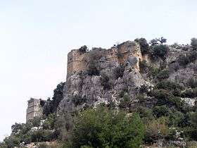
- Akkale (in the modern village of Tırtar)- the ruins of a large Byzantine building, possibly a palace, with baths, a water tank and large tank for storing olive oil.
- Emirzeli - the ruins of an ancient city with traces of Hellenistic, Ancient Roman and Byzantine architecture including a church, a tower, water storage and houses.
- Çatıören - a Hellenistic city with temple of Hermes and necropolis.
- Öküzlü - the foundations of an ancient city, with a basilica, water tanks and monumental stones.
- Corycus and Kızkalesi - Findings in the necropolis inform us that the city of Corycus dates back the 4th century BC, in the 1st century they minted coinage here. The nearby castle of Kızkalesi Ghorgos was built on an island offshore in the 12th century.
- Elaiussa Sebaste - founded in the 2nd century, but thrived under the Romans and Byzantines,the site includes a necropolis, theatre and waterworks.
- Canytelis - occupied since the 3rd century BC, the site includes rock tombs and a Hellenistic period tower.
- Paşa Türbesi - a small Seljuk era (13th century) tomb
and there are many more remains from antiquity in the area.
Gallery
References
- ↑ "Area of regions (including lakes), km²". Regional Statistics Database. Turkish Statistical Institute. 2002. Retrieved 2013-03-05.
- ↑ "Population of province/district centers and towns/villages by districts - 2012". Address Based Population Registration System (ABPRS) Database. Turkish Statistical Institute. Retrieved 2013-02-27.
External links
| Wikimedia Commons has media related to Erdemli. |
- District governor's official website (Turkish)
- District municipality's official website (Turkish)
- Erdemli
- Mersin University
- Mersin haberleri


.jpg)
