Eye Brook


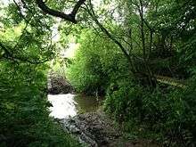
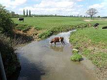
The Eye Brook is a river in the East Midlands of England, a tributary of the River Welland. It is around 10 miles (16 km) long.[1][2]
Rising near Tilton on the Hill or Skeffington in Leicestershire, it flows east. Near where it crosses the A47, it starts to form the county boundary between Leicestershire and Rutland, and goes between Belton-in-Rutland to the north, and Allexton to the south. It then proceeds south-eastwards. Between Stoke Dry and Caldecott it is dammed to form the Eyebrook Reservoir. Soon after this, it joins the River Welland (here forming the border with Northamptonshire).
Much of the land surrounding the area is a Site of Special Scientific Interest[3] and a report by English Nature considered the river to be one of the most "natural" in the county having experienced very little human intervention.
The Eye Brook Community Heritage Project, funded by the Heritage Lottery, documents the evolution of land use within the Brook's catchment, the management and use of natural resources associated with it, and the underlying ecology.[4]
The river holds a variety of fish species, including roach, dace and chub. Wild brown trout spawn in the lower reaches.[4]
Coordinates: 52°31′47″N 0°42′32″W / 52.5298°N 0.7089°W
References
- ↑ Wheeler and Batty (1896), p.291
- ↑ "Welland catchment map" (PDF). Environment Agency. Retrieved 25 May 2013.
- ↑ "Eyebrook valley" (PDF). Discover Rutland. Retrieved 2 June 2013.
- 1 2 The Game & Wildlife Conservation Trust
Bibliography
- William Henry Wheeler; Leonard Charles Batty (1896). A History of the Fens of South Lincolnshire. British Library Historical Print Collections. ISBN 978-1-241-32839-9.
External links
- "Great Merrible Wood". Leicestershire and Rutland Wildlife Trust. Retrieved 2 June 2013.
part of the Eye Brook Valley Woods Site of Special Scientific Interest.