Fjaðrárgljúfur
Coordinates: 63°46′16.5″N 18°10′19″W / 63.771250°N 18.17194°W
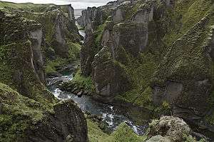
View of Fjaðrárgljúfur Canyon looking towards the Ocean, Iceland

View of Fjaðrárgljúfur Canyon looking upstream, Iceland
Fjaðrárgljúfur is a canyon in south east Iceland which is up to 100 m deep[1] and about 2 kilometres long, with the Fjaðrá river flowing through it.[2] It is located near the Ring Road, not far from the village of Kirkjubæjarklaustur.[3]
The canyon was created by progressive erosion by flowing water from glaciers through the rocks and palagonite over millennia.[4]
References
- ↑ "EnjoyIceland.is - Fjaðrárgljúfur - A canyon - South East Iceland". enjoyiceland.is. Retrieved 19 Sep 2012.
- ↑ Collectif; Dominique Auzias; Jean-Paul Labourdette (27 April 2011). Islande. Petit Futé. pp. 188–. ISBN 978-2-7469-4837-2. Retrieved 19 September 2012.
- ↑ Jane Victoria Appleton; Lisa Gail Shannen (16 December 2010). Frommer's Iceland. John Wiley & Sons. pp. 274–. ISBN 978-1-119-99443-5. Retrieved 19 September 2012.
- ↑ Íslandshandbókin. 2. bindi. 1989, S.695
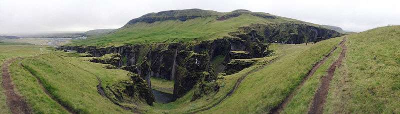
Fjadrárgljúfur, viewed from the tourist footpath.
| Wikimedia Commons has media related to Fjaðrárgljúfur. |
This article is issued from Wikipedia - version of the 11/24/2016. The text is available under the Creative Commons Attribution/Share Alike but additional terms may apply for the media files.