Fontanes, Lozère
| Fontanes | ||
|---|---|---|
|
Sheep on the high plateau, in Fontanes | ||
| ||
 Fontanes | ||
|
Location within Occitanie region 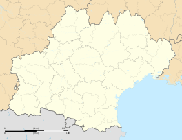 Fontanes | ||
| Coordinates: 44°46′15″N 3°47′10″E / 44.7708°N 3.7861°ECoordinates: 44°46′15″N 3°47′10″E / 44.7708°N 3.7861°E | ||
| Country | France | |
| Region | Occitanie | |
| Department | Lozère | |
| Arrondissement | Mende | |
| Canton | Langogne | |
| Intercommunality | Haut Allier | |
| Government | ||
| • Mayor (2008–2014) | Jean-Louis Brun[1] | |
| Area1 | 11.28 km2 (4.36 sq mi) | |
| Population (1999)2 | 110 | |
| • Density | 9.8/km2 (25/sq mi) | |
| Time zone | CET (UTC+1) | |
| • Summer (DST) | CEST (UTC+2) | |
| INSEE/Postal code | 48062 / 48300 | |
| Elevation |
791–1,075 m (2,595–3,527 ft) (avg. 1,000 m or 3,300 ft) | |
|
1 French Land Register data, which excludes lakes, ponds, glaciers > 1 km² (0.386 sq mi or 247 acres) and river estuaries. 2 Population without double counting: residents of multiple communes (e.g., students and military personnel) only counted once. | ||
%2C_moutons_sur_le_haut_plateau.JPG)

Fontanes is a former commune in the Lozère department in southern France. On 1 January 2016, it was merged into the new commune of Naussac-Fontanes.[2]
See also
References
- ↑ Site du conseil général de la Lozère
- ↑ Arrêté préfectoral 29 September 2015
| Wikimedia Commons has media related to Fontanes (Lozère). |
This article is issued from Wikipedia - version of the 3/3/2016. The text is available under the Creative Commons Attribution/Share Alike but additional terms may apply for the media files.