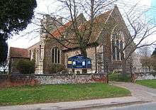
Fordham, Essex

Fordham is a village and civil parish in the Colchester district of the English county of Essex, six miles north-west of the town of Colchester. It has a population of about 800, measured at 835 in the 2011 Census.[1] The parish includes the nearby hamlets of Fordham Heath and Hemp's Green.
Features and facilities
Fordham is bounded to the south by the River Colne. It has a post office, a school, a place of worship and a historic pub, The Three Horseshoes. Another pub also in a historic building, The Shoulder of Mutton, closed in March 2013. There is a fair held every year on the first Saturday of July, and a vehicle show on the second Sunday of August. An area of 500 acres in the parish was turned over for future woodland to the Woodland Trust in 2001.[2]
Church
All Saints' Anglican Church dates from about 1340 and is a Grade I listed building.[3] It was restored in 1861. There was also a chapel of the Countess of Huntingdon's Connexion in the village in the 19th century.[4]
Among the past rectors of the parish of Fordham was Roger Walden (died 1406), who was briefly Archbishop of Canterbury and then Bishop of London.[5] The noted classical scholar Thomas Twining, a member of the tea-merchant family, held the curacy of the church from 1764 until his death in 1804.[6]
Governance
Fordham is part of the electoral ward of Fordham and Stour Valley. The population of this ward at the 2011 census was 5,332.[7]
References
- ↑ "Civil Parish population 2011". Retrieved 29 September 2015.
- ↑ Fordham site. Retrieved 1 October 2014
- ↑ "Name: CHURCH OF ALL SAINTS List entry Number: 1239789". English Heritage. Retrieved 21 April 2014.
- ↑ A Vision of Britain through Time. Retrieved 1 October 2014.
- ↑ Pat Lewis: All Saints Church, Fordham, Essex. Notes on the Rectors, 2009 Retrieved 1 October 2014.; Fryde Handbook of British Chronology, p. 233.
- ↑ ODNB entry: Retrieved 26 June 2011. Subscription required.
- ↑ "Fordham and Stour Valley ward population 2011". Retrieved 29 September 2011.
Coordinates: 51°55′22″N 0°48′13″E / 51.9228°N 0.8035°E