Frantschach-Sankt Gertraud
| Frantschach-St. Gertraud | ||
|---|---|---|
|
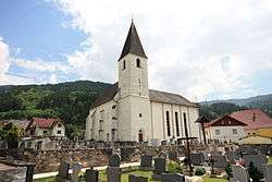
Church | ||
| ||
 Frantschach-St. Gertraud Location within Austria | ||
| Coordinates: 46°52′N 14°52′E / 46.867°N 14.867°ECoordinates: 46°52′N 14°52′E / 46.867°N 14.867°E | ||
| Country | Austria | |
| State | Carinthia | |
| District | Wolfsberg | |
| Government | ||
| • Mayor | Günther Vallant | |
| Area | ||
| • Total | 100.97 km2 (38.98 sq mi) | |
| Elevation | 503 m (1,650 ft) | |
| Population (1 January 2016)[1] | ||
| • Total | 2,661 | |
| • Density | 26/km2 (68/sq mi) | |
| Time zone | CET (UTC+1) | |
| • Summer (DST) | CEST (UTC+2) | |
| Postal code | 9413 | |
| Area code | 04252 | |
| Website | www.frantschach-st-gertraud.gv.at | |

Frantschach-Sankt Gertraud is a town in the district of Wolfsberg in the Austrian state of Carinthia.
Geography
The municipality lies north of Wolfsberg on the boundary with Styria.
References
| Wikimedia Commons has media related to Frantschach-Sankt Gertraud. |
This article is issued from Wikipedia - version of the 5/24/2014. The text is available under the Creative Commons Attribution/Share Alike but additional terms may apply for the media files.