Ganpur
| Ganpur | |
|---|---|
| village | |
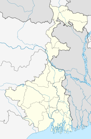 Ganpur  Ganpur Location in West Bengal, India | |
| Coordinates: 24°24′N 87°23′E / 24.4°N 87.39°ECoordinates: 24°24′N 87°23′E / 24.4°N 87.39°E | |
| Country [1] |
|
| State | West Bengal |
| District | Birbhum |
| Languages | |
| • Official | Bengali, English |
| Time zone | IST (UTC+5:30) |
| PIN | 731216 |
| Lok Sabha constituency | Birbhum |
| Vidhan Sabha constituency | Rampurhat |
| Website |
birbhum |
Ganpur is an old village in Birbhum district, West Bengal, India. It is situated beside NH 60. This village is surrounded on four sides with "Ganpur reserved forests".[2] A narrow canal passes through south of the village. Ganpur is mainly covered with moram soil, and this sal forest is on moram soil.The villagers, living in villages (Ulpahari, ghaga, choubata, shabla etc.) located inside the forest, have realised that they can make a living by selling plates (thalis/"tharis") made of sal leaves.[3]
Population and census data
There are 682 House Holds in Ganpur, and 1,347 males (50%) & 1,359 females (50%). Scheduled Cast are 874 (32%) & Scheduled tribe are 12 (0% ). Literates in Ganpur are 2,059 (76%) & 647 total Illiterates (24% ). Workers are 958 (35%). 795 are regular and 163 are irregular.There are 1,748 Non Workers (65%).[4]
References
- ↑ wikimapia.org
- ↑ http://wikimapia.org/22953593/Ganpur-forest
- ↑ Ghosh, Kanailal, Birbhumer Bon Udbhidjo O Banyapran, Paschim Banga, Birbhum Special Issue, February 2006, (Bengali),
- ↑ Census of India and http://ourhero.in/population/villages/ganpur-316767