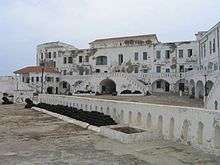
Ghana's material cultural heritage
The monuments list is taken from the Ghana Museums and Monuments Board, according to their description "legal custodian of Ghana’s material cultural heritage (movable and immovable heritage)"[1] GMMB classifies the monuments:
The ID used on this page in reference to the Regions of Ghana are based on the ISO Regional ID standards.
A. Western Region
B. Central Region
C. Greater Accra Region
| ID | Description | Region | Original function | Built | Location | Address | Comment | Coordinates | Image |
|---|---|---|---|---|---|---|---|---|---|
| GH-AA-001 | National Museum | Greater Accra | Museum | 1957 | Barnes Road, Accra | 5°33′24″N 0°12′28″W / 5.556667°N 0.207778°W | 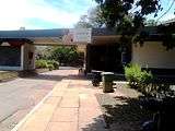 | ||
| GH-AA-002 | Museum of Science & Technology | Greater Accra | Museum | 1963 | Main Entrance of Science and Technology Museum.jpg |  | |||
| GH-AA-006 | Ussher Fort | Greater Accra | Fort | 1649 | Ussher Town, Accra | | |||
| GH-AA-007 | Ussher Fort Museum | Greater Accra | Museum | Ussher Town, Accra |  | ||||
| GH-AA-008 | James Fort | Greater Accra | Fort | 1673 | Jamestown, Accra | | |||
| GH-AA-010 | Christiansborg Castle a.k.a. Osu Castle |
Greater Accra | Fort | 1659 | Osu, Accra | _2.jpg) | |||
| GH-AA-011 | Fort Augustaborg | Greater Accra | Fort | 1787 | Teshie |  | |||
| GH-AA-012 | Museum of Archaeology | Greater Accra | Museum | University of Ghana, Department of Archeology, Accra |  | ||||
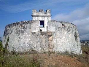
| GH-EP-001 | Fort Vernon | Greater Accra | Fort | 1742 | Prampram | 5°43′29″N 0°07′00″E / 5.7247051°N 0.1167463°E |  | ||
| GH-EP-002 | Fort Fredensborg | Eastern | Fort | 1736 - 42 | Old Ningo | 5°45′00″N 0°11′00″E / 5.75°N 0.1833333°E | 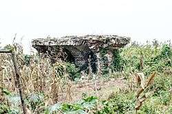 |
E. Volta Region
| ID | Description | Region | Original function | Built | Location | Address | Comment | Coordinates | Image |
|---|---|---|---|---|---|---|---|---|---|
| GH-TV-001 | Fort Prinzenstein | Volta | Fort | 1734 | Keta | 5°54′39″N 0°59′31″E / 5.910833°N 0.991944°E |  | ||
| GH-TV-002 | Volta Regional Museum | Volta | Museum | 1973 | Ho |  |
F. Ashanti Region
| ID | Description | Region | Original function | Built | Location | Address | Comment | Coordinates | Image |
|---|---|---|---|---|---|---|---|---|---|
| GH-AH-001 | Fort Kumasi | Ashanti | Fort | 1820 | Kumasi | .jpg) | |||
| GH-AH-002 | Kumasi Military Museum | Ashanti | Museum | Kumasi | 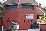 | ||||
| GH-AH-003 | Yaw Tano Shrine a.k.a. Tano Yaw Shrine |
Ashanti | Shrine | Ejisu-Besease | at Besease, about 20.8 km on the Kumasi-Accra road. | 5°33′26″N 1°11′45″W / 5.5572433°N 1.1959147°W |  | ||
| GH-AH-004 | Akwasi Sima Shrine a.k.a. Kwasi Kuma Shrine |
Ashanti | Shrine | Adarkwa Jachie | about 16 km on the Kumasi-Ejisu road. | 
| |||
| GH-AH-005 | Tano Abenamu Subunu Shrine | Ashanti | Shrine | Abirem | Abirem is about 12.8 km from Kumasi on the Antoa Road, Coord of Antoa Road | 6°42′30″N 1°36′20″W / 6.7082007°N 1.605463°W | 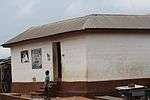 | ||
| GH-AH-006 | Tano Kwadwo Shrine | Ashanti | Shrine | Saaman | Saaman is about 12.6 km north-east of Kumasi, on the former Odumakoma Tempong road that led toNorthern Ghana. |  | |||
| GH-AH-007 | Atuo Kosua Shrine | Ashanti | Shrine | Adwinase | off the Ejisu-Onwi road. |  | |||
| GH-AH-008 | Kentinkrono Shrine | Ashanti | Shrine | Kentinkrono | At Kentinkrono, about 20.8km on the Kumasi-Ejisu road. |  | |||
| GH-AH-009 | Tano Odomankoma Shrine | Ashanti | Shrine | Bogwiase | foot of the rocky Mampong scarp, about 10 km from Effiduase, in theSekyere West District. | 
| |||
| GH-AH-010 | Asawase Shrine a.k.a. Tano Banie Shrine |
Ashanti | Shrine | Asawase near Ejisu | to the south of Ejisu, about 10 km on the second-class road linking Ejisu and Apromase. | 
| |||
| GH-AH-011 | Asenemaso Shrine | Ashanti | Shrine | Asenemaso | Kumasi-Sunyani road, at a distance of about 15 km from Kejetia. |  |
G. Northern Region
| ID | Description | Region | Original function | Built | Location | Address | Comment | Coordinates | Image |
|---|---|---|---|---|---|---|---|---|---|
| GH-NP-001 | Larabanga Mosque | Northern Region | Mosque | 14th Century |  |
Upper East
| ID | Description | Region | Original function | Built | Location | Address | Comment | Coordinates | Image |
|---|---|---|---|---|---|---|---|---|---|
| GH-UE-001 | Upper East Regional Museum | Upper East | Museum | Bolgatanga |  |
Archeological Sites
It is not clear what to do with the.[3] It is listed on the QMMB site, and contains information about:
References
This article is issued from Wikipedia - version of the 11/6/2016. The text is available under the Creative Commons Attribution/Share Alike but additional terms may apply for the media files.


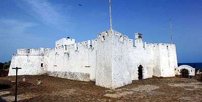


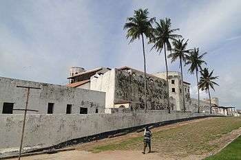

.jpg)


%2C_zeezijde.jpg)

.jpg)
