Grade II* listed buildings in Redditch

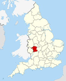
Worcestershire shown within England
There are over 20,000 Grade II* listed buildings in England. This page is a list of these buildings in the district of Redditch in Worcestershire.
Redditch
| Name | Location | Type | Completed [note 1] | Date designated | Grid ref.[note 2] Geo-coordinates |
Entry number [note 3] | Image |
|---|---|---|---|---|---|---|---|
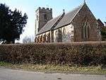
| Church of St John the Baptist | Feckenham, Redditch | Parish Church | 12th century | 10 April 1954 | SP0091161648 52°15′11″N 1°59′17″W / 52.253006°N 1.988075°W |
1167686 | .jpg) |
| Lanehouse Farmhouse | Feckenham, Redditch | Farmhouse | 1550 | 28 November 1986 | SP0238164340 52°16′38″N 1°57′59″W / 52.277204°N 1.966523°W |
1100024 | 
|
| Middle Beanhall Farmhouse | Bradley Green, Feckenham, Redditch | Farmhouse | Early 16th century | 10 April 1954 | SO9902460824 52°14′44″N 2°00′57″W / 52.245597°N 2.015715°W |
1348639 | 
|
| The Manor | Feckenham, Redditch | House | Late 16th century | 10 April 1954 | SP0066261366 52°15′02″N 1°59′30″W / 52.250471°N 1.991723°W |
1348645 | .jpg) |
| White House Farmhouse | Feckenham, Redditch | Farmhouse | c. 1640 | 10 April 1954 | SP0219764454 52°16′42″N 1°58′09″W / 52.278229°N 1.969219°W |
1167023 | 
|
| Church of St Peter | Ipsley, Redditch | Church | 13th century | 10 April 1954 | SP0652866548 52°17′49″N 1°54′21″W / 52.297021°N 1.905699°W |
1100022 |  |
| Holmwood House | Holmwood, Redditch | Country House | 1893 | 16 July 1987 | SP0340867187 52°18′10″N 1°57′05″W / 52.302794°N 1.951443°W |
1348660 | 
|
| Lovelyne Farmhouse | Redditch | Farmhouse | Late 16th century | 4 December 1973 | SP0282164372 52°16′39″N 1°57′36″W / 52.277489°N 1.960074°W |
1166986 | 
|
| Shurnock Court | Redditch | House | 17th century | 28 November 1986 | SP0263460882 52°14′46″N 1°57′46″W / 52.246114°N 1.962841°W |
1099994 | 
|
| Tookeys Farmhouse | Astwood Bank, Redditch | Farmhouse | 16th century | 10 April 1954 | SP0401961842 52°15′17″N 1°56′33″W / 52.254737°N 1.942544°W |
1100061 |  |
Notes
- ↑ The date given is the date used by Historic England as significant for the initial building or that of an important part in the structure's description.
- ↑ Sometimes known as OSGB36, the grid reference is based on the British national grid reference system used by the Ordnance Survey.
- ↑ The "List Entry Number" is a unique number assigned to each listed building and scheduled monument by Historic England.
References
English Heritage Images of England
External links
![]() Media related to Grade II* listed buildings in Worcestershire at Wikimedia Commons
Media related to Grade II* listed buildings in Worcestershire at Wikimedia Commons
This article is issued from Wikipedia - version of the 6/26/2015. The text is available under the Creative Commons Attribution/Share Alike but additional terms may apply for the media files.