Grade II* listed buildings in Waveney

There are over 20,000 Grade II* listed buildings in England. This page is a list of these buildings in the district of Waveney in Suffolk.

Waveney

Name Location Type Completed [note 1]Date designated Grid ref.[note 2]
Geo-coordinates
Entry number [note 3]Image
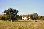
Brook Farmhouse All Saints and St. Nicholas, South Elmham Farmhouse Early to mid 16th century 27 April 1987 TM3205082726
52°23′36″N 1°24′33″E / 52.393336°N 1.409118°E / 52.393336; 1.409118 (Brook Farmhouse)
1352625
The Elms All Saints, All Saints and St. Nicholas, South Elmham Farmhouse 15th century 16 March 1972 TM3325182488
52°23′26″N 1°25′36″E / 52.39069°N 1.42657°E / 52.39069; 1.42657 (The Elms)
1352623
Whaley's All Saints, All Saints and St. Nicholas, South Elmham Farmhouse Mid to late 16th century 27 April 1987 TM3394682489
52°23′25″N 1°26′12″E / 52.390403°N 1.436765°E / 52.390403; 1.436765 (Whaley's)
1032000
White House All Saints and St. Nicholas, South Elmham Farmhouse c.1600 1 September 1953 TM3417582929
52°23′39″N 1°26′26″E / 52.394254°N 1.440431°E / 52.394254; 1.440431 (White House)
1284035
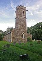
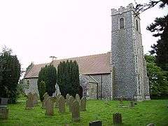
Church of St John the Baptist Barnby Parish Church Medieval 17 April 1986 TM4807389938
52°27′04″N 1°38′58″E / 52.451022°N 1.64946°E / 52.451022; 1.64946 (Church of St John the Baptist)
1032106
Ashmans Hall Barsham Country House c.1820 1 September 1953 TM4128289735
52°27′08″N 1°32′58″E / 52.452239°N 1.549581°E / 52.452239; 1.549581 (Ashmans Hall)
1032032
Northgate House Beccles House 18th century 16 March 1948 TM4216290654
52°27′36″N 1°33′47″E / 52.460096°N 1.563172°E / 52.460096; 1.563172 (Northgate House)
1205862
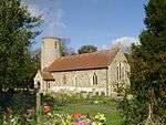
Church of St Michael Benacre Parish Church Medieval 17 April 1986 TM5116284460
52°24′02″N 1°41′27″E / 52.400467°N 1.690707°E / 52.400467; 1.690707 (Church of St Michael)
1032110
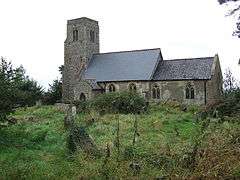
Church of St Margaret Stoven, Brampton with Stoven Tower Medieval 1 September 1953 TM4479281610
52°22′40″N 1°35′43″E / 52.377779°N 1.595188°E / 52.377779; 1.595188 (Church of St Margaret)
1032100
Ollands and The Gables St John's Rd, Bungay Houses Post 1654 9 May 1949 TM3409689176
52°27′01″N 1°26′37″E / 52.450347°N 1.443642°E / 52.450347; 1.443642 (Ollands and The Gables)
1275692
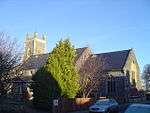
Roman Catholic Church of St Edmund Bungay Roman Catholic Church 1889-1901 5 March 1998 TM3369589680
52°27′18″N 1°26′17″E / 52.455041°N 1.438105°E / 52.455041; 1.438105 (Roman Catholic Church of St Edmund)
1376754
Rose Hall Upper Olland St, Bungay House 1739 9 May 1949 TM3371689316
52°27′06″N 1°26′17″E / 52.451766°N 1.438159°E / 52.451766; 1.438159 (Rose Hall)
1275077
Trinity Hall Staithe Rd, Bungay House 18th century 9 May 1949 TM3388189756
52°27′20″N 1°26′27″E / 52.455644°N 1.44089°E / 52.455644; 1.44089 (Trinity Hall)
1216991
Church of St Peter Carlton Colville Parish Church Medieval 17 April 1986 TM5100090143
52°27′05″N 1°41′33″E / 52.451526°N 1.692594°E / 52.451526; 1.692594 (Church of St Peter)
1352577
Church of St Bartholomew Corton Parish Church Medieval 27 November 1954 TM5384498062
52°31′17″N 1°44′25″E / 52.521253°N 1.740382°E / 52.521253; 1.740382 (Church of St Bartholomew)
1352637
Church of St Mary Flixton, The Saints Parish Church Before 1086 1 September 1953 TM3121186693
52°25′45″N 1°23′58″E / 52.429291°N 1.399549°E / 52.429291; 1.399549 (Church of St Mary)
1031989
Dovecote at Flixton Hall Flixton, The Saints Dovecote Early 17th century 1 September 1953 TM3049285903
52°25′21″N 1°23′18″E / 52.422505°N 1.388449°E / 52.422505; 1.388449 (Dovecote at Flixton Hall)
1031986
Hill Farmhouse Flixton, The Saints Farmhouse Early 16th century 27 April 1987 TM3140487151
52°26′00″N 1°24′10″E / 52.43332°N 1.4027°E / 52.43332; 1.4027 (Hill Farmhouse)
1031987
Church of St Mary the Virgin Halesworth Church 14th century 21 October 1949 TM3860277364
52°20′33″N 1°30′05″E / 52.342407°N 1.501412°E / 52.342407; 1.501412 (Church of St Mary the Virgin)
1267069
Former Almshouses Halesworth Shop 1949 21 October 1949 TM3859077321
52°20′31″N 1°30′04″E / 52.342027°N 1.501206°E / 52.342027; 1.501206 (Former Almshouses)
1224060
Gothic House 1, London Road, Halesworth House 1603-1625 21 October 1949 TM3866577335
52°20′32″N 1°30′08″E / 52.34212°N 1.502315°E / 52.34212; 1.502315 (Gothic House)
1239856
The Social Club Halesworth Jettied House 16th century 21 October 1949 TM3853777404
52°20′34″N 1°30′02″E / 52.342795°N 1.500488°E / 52.342795; 1.500488 (The Social Club)
1223564
Church of St Peter Holton Parish Church Medieval 1 September 1953 TM4025677875
52°20′47″N 1°31′34″E / 52.346271°N 1.526009°E / 52.346271; 1.526009 (Church of St Peter)
1352566
Church of St John the Baptist Lound Parish Church Medieval 27 November 1954 TM5063498995
52°31′52″N 1°41′38″E / 52.531107°N 1.693876°E / 52.531107; 1.693876 (Church of St John the Baptist)
1183409
Mutford Hall Mutford House 19th century 17 April 1986 TM4809787512
52°25′45″N 1°38′53″E / 52.429246°N 1.648012°E / 52.429246; 1.648012 (Mutford Hall)
1352581
Manor House Oulton House Late 16th century 13 December 1949 TM5254494862
52°29′35″N 1°43′08″E / 52.493149°N 1.718837°E / 52.493149; 1.718837 (Manor House)
1292479
Church of St Margaret Reydon Parish Church Medieval 27 November 1954 TM4909478189
52°20′43″N 1°39′21″E / 52.345149°N 1.65572°E / 52.345149; 1.65572 (Church of St Margaret)
1032142
Church of All Saints Ringsfield Parish Church Medieval 1 September 1953 TM4031588429
52°26′27″N 1°32′04″E / 52.440947°N 1.53444°E / 52.440947; 1.53444 (Church of All Saints)
1032044
Hatton's Farmhouse Rumburgh Farmhouse C20 23 April 1986 TM3617981752
52°22′58″N 1°28′08″E / 52.382832°N 1.468998°E / 52.382832; 1.468998 (Hatton's Farmhouse)
1283698
Rushmere Hall Rushmere Farmhouse Late 16th century 17 April 1986 TM4924587330
52°25′38″N 1°39′53″E / 52.427091°N 1.664725°E / 52.427091; 1.664725 (Rushmere Hall)
1284310
Hill Farmhouse Shadingfield Farmhouse Early-Mid 16th century 1 September 1953 TM4346883516
52°23′44″N 1°34′38″E / 52.39547°N 1.57716°E / 52.39547; 1.57716 (Hill Farmhouse)
1352589
Moat Farmhouse Shadingfield Farmhouse Mid 16th century 1 September 1953 TM4280485145
52°24′37″N 1°34′07″E / 52.410382°N 1.568602°E / 52.410382; 1.568602 (Moat Farmhouse)
1032132
Barn 30 Metres North of Manor Farmhouse Shipmeadow Barn Late 19th century 1 November 1988 TM3790490322
52°27′32″N 1°30′01″E / 52.458987°N 1.500386°E / 52.458987; 1.500386 (Barn 30 Metres North of Manor Farmhouse)
1352629
Church of St Bartholomew Shipmeadow Parish Church Medieval 1 September 1953 TM3820289981
52°27′21″N 1°30′16″E / 52.455797°N 1.50452°E / 52.455797; 1.50452 (Church of St Bartholomew)
1032004
Barn 70 Metres East North East of Park Farmhouse Somerleyton, Ashby and Herringfleet Timber Framed Barn 16th century 29 January 1987 TM5040798202
52°31′27″N 1°41′24″E / 52.524097°N 1.689939°E / 52.524097; 1.689939 (Barn 70 Metres East North East of Park Farmhouse)
1284051
Church of St Mary Somerleyton, Somerleyton, Ashby and Herringfleet Parish Church 15th century 27 November 1954 TM4930597211
52°30′57″N 1°40′23″E / 52.515711°N 1.672988°E / 52.515711; 1.672988 (Church of St Mary)
1183419
Herringfleet Marsh Mill Herringfleet, Somerleyton, Ashby and Herringfleet Drainage Mill c.1820 27 November 1954 TM4654397625
52°31′14″N 1°37′58″E / 52.520681°N 1.632676°E / 52.520681; 1.632676 (Herringfleet Marsh Mill)
1183297
Kitchen Garden of Somerleyton Hall Somerleyton Park, Somerleyton, Ashby and Herringfleet Garden c.1846 29 January 1987 TM4923997979
52°31′21″N 1°40′21″E / 52.522632°N 1.672593°E / 52.522632; 1.672593 (Kitchen Garden of Somerleyton Hall)
1031936
Somerleyton Hall Somerleyton Hall, Somerleyton, Ashby and Herringfleet Country House 16th century 29 January 1987 TM4928397769
52°31′15″N 1°40′23″E / 52.520728°N 1.673083°E / 52.520728; 1.673083 (Somerleyton Hall)
1198046
Stable Court to Somerleyton Hall Somerleyton Park, Somerleyton, Ashby and Herringfleet Courtyard 1846 29 January 1987 TM4930397834
52°31′17″N 1°40′24″E / 52.521302°N 1.673425°E / 52.521302; 1.673425 (Stable Court to Somerleyton Hall)
1352646
Church Farmhouse Sotherton Farmhouse Mid 16th century 1 September 1953 TM4415679538
52°21′34″N 1°35′04″E / 52.359472°N 1.584357°E / 52.359472; 1.584357 (Church Farmhouse)
1183173
Church of St Andrew Sotherton Parish Church Medieval 1 September 1953 TM4412279484
52°21′32″N 1°35′02″E / 52.359002°N 1.583819°E / 52.359002; 1.583819 (Church of St Andrew)
1352590
Buckenham House Southwold House Early 17th century addition 21 April 1949 TM5076376161
52°19′34″N 1°40′43″E / 52.326195°N 1.678657°E / 52.326195; 1.678657 (Buckenham House)
1384375
Lloyds Bank Southwold Town House 1716 21 April 1949 TM5080176122
52°19′33″N 1°40′45″E / 52.325827°N 1.679185°E / 52.325827; 1.679185 (Lloyds Bank)
1384386
Manor House and Manor Gate including Forecourt Walls Southwold House c.1750 21 April 1949 TM5069976219
52°19′36″N 1°40′40″E / 52.326744°N 1.677763°E / 52.326744; 1.677763 (Manor House and Manor Gate including Forecourt Walls)
1384370
Sutherland House 56, High Street, Southwold House Remodelled early 19th century 21 April 1949 TM5066776289
52°19′39″N 1°40′38″E / 52.327387°N 1.677347°E / 52.327387; 1.677347 (Sutherland House)
1384369
Church of St Peter Spexhall Parish Church 12th century 1 September 1953 TM3783280175
52°22′05″N 1°29′32″E / 52.367966°N 1.492121°E / 52.367966; 1.492121 (Church of St Peter)
1032046
The Huntsman and Hounds Stone Street, Spexhall Timber Framed House Mid 16th century 1 September 1953 TM3823582638
52°23′24″N 1°29′59″E / 52.389892°N 1.499777°E / 52.389892; 1.499777 (The Huntsman and Hounds)
1032051
Church of St John the Baptist St John, Ilketshall Parish Church Medieval 1 September 1953 TM3601887563
52°26′06″N 1°28′15″E / 52.435046°N 1.470732°E / 52.435046; 1.470732 (Church of St John the Baptist)
1032020
Church of St Lawrence St Lawrence, Ilketshall Parish Church 13th century 1 September 1953 TM3677586377
52°25′27″N 1°28′52″E / 52.424077°N 1.481007°E / 52.424077; 1.481007 (Church of St Lawrence)
1197944
Boundary Farmhouse St Margaret, Ilketshall Farmhouse Early 16th century 1 September 1953 TM3563883460
52°23′54″N 1°27′44″E / 52.398392°N 1.462265°E / 52.398392; 1.462265 (Boundary Farmhouse)
1032023
Rookery Farmhouse St Margaret's Green, St Margaret, South Elmham Farmhouse 16th century 1 September 1953 TM3238683467
52°23′59″N 1°24′52″E / 52.399843°N 1.41456°E / 52.399843; 1.41456 (Rookery Farmhouse)
1198346
Church of St Mary South Elmham St. Mary, otherwise Homersfield Parish Church 12th century 1 September 1953 TM2855985398
52°25′08″N 1°21′35″E / 52.418783°N 1.359729°E / 52.418783; 1.359729 (Church of St Mary)
1031994
Church of St Peter St Peter, South Elmham Parish Church Norman 1 September 1953 TM3359584809
52°24′41″N 1°26′00″E / 52.411372°N 1.433234°E / 52.411372; 1.433234 (Church of St Peter)
1283860
St Peter's Hall St Peter, South Elmham House 19th century 1 September 1953 TM3360085342
52°24′58″N 1°26′01″E / 52.416153°N 1.433679°E / 52.416153; 1.433679 (St Peter's Hall)
1031979
Uggeshall Hall Uggeshall Farmhouse C16-C17 17 March 1986 TM4568681510
52°22′35″N 1°36′30″E / 52.376482°N 1.608222°E / 52.376482; 1.608222 (Uggeshall Hall)
1183331
Beacon Farmhouse Westhall Farmhouse Mid 16th century 1 September 1953 TM4192881381
52°22′37″N 1°33′11″E / 52.376996°N 1.553032°E / 52.376996; 1.553032 (Beacon Farmhouse)
1352610
Slough Farmhouse Westhall Farmhouse Mid 16th century 23 April 1986 TM3947483078
52°23′36″N 1°31′06″E / 52.3933°N 1.518263°E / 52.3933; 1.518263 (Slough Farmhouse)
1198991
Weston Hall Weston Country House Late 16th century 1 September 1953 TM4259087143
52°25′42″N 1°34′01″E / 52.428404°N 1.56691°E / 52.428404; 1.56691 (Weston Hall)
1032008
Manor Farmhouse Wissett Farmhouse Early 16th century 23 April 1986 TM3608579678
52°21′51″N 1°27′58″E / 52.364261°N 1.46616°E / 52.364261; 1.46616 (Manor Farmhouse)
1032067
The Grange Wissett House 16th century 1 September 1953 TM3634279495
52°21′45″N 1°28′11″E / 52.362508°N 1.469799°E / 52.362508; 1.469799 (The Grange)
1199370
Church of All Saints Worlingham Parish Church Medieval 27 June 1986 TM4451089836
52°27′06″N 1°35′49″E / 52.451712°N 1.597061°E / 52.451712; 1.597061 (Church of All Saints)
1182968
United Reformed Church Wrentham Chapel 1778 27 November 1954 TM4972882703
52°23′07″N 1°40′06″E / 52.385359°N 1.668365°E / 52.385359; 1.668365 (United Reformed Church)
1032152
Church of St Margaret and All Saints Saxon Rd, Lowestoft Parish Church 13th century 13 December 1949 TM5386090496
52°27′12″N 1°44′05″E / 52.453372°N 1.734857°E / 52.453372; 1.734857 (Church of St Margaret and All Saints)
1207045
Church of St Peter Gunton, Lowestoft Parish Church 12th century 13 December 1949 TM5422995752
52°30′01″N 1°44′39″E / 52.500351°N 1.74428°E / 52.500351; 1.74428 (Church of St Peter)
1208952
Church of St Peter and St John Kirkley, Lowestoft Parish Church Early 15th century 3 October 1977 TM5405291567
52°27′46″N 1°44′19″E / 52.462891°N 1.738491°E / 52.462891; 1.738491 (Church of St Peter and St John)
1207046
Royal Norfolk and Suffolk Yacht Club Lowestoft Sailing Club 1902-03 3 May 1979 TM5480092618
52°28′19″N 1°45′01″E / 52.471971°N 1.750279°E / 52.471971; 1.750279 (Royal Norfolk and Suffolk Yacht Club)
1207043
36 High Street Lowestoft House 1949-50 13 December 1949 TM5516693932
52°29′01″N 1°45′24″E / 52.483587°N 1.75666°E / 52.483587; 1.75666 (36 High Street)
1292849

Notes

  1. The date given is the date used by Historic England as significant for the initial building or that of an important part in the structure's description.
  2. Sometimes known as OSGB36, the grid reference is based on the British national grid reference system used by the Ordnance Survey.
  3. The "List Entry Number" is a unique number assigned to each listed building and scheduled monument by Historic England.

Media related to Grade II* listed buildings in Suffolk at Wikimedia Commons

This article is issued from Wikipedia - version of the 8/31/2016. The text is available under the Creative Commons Attribution/Share Alike but additional terms may apply for the media files.