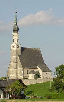
Helpfau-Uttendorf
| Helpfau-Uttendorf | ||
|---|---|---|
 | ||
| ||
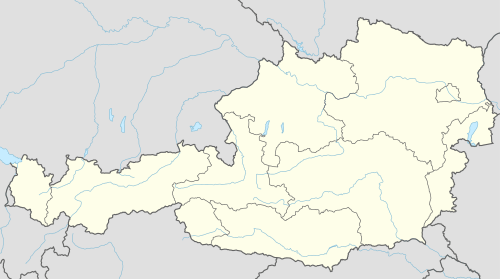 Helpfau-Uttendorf Location within Austria | ||
| Coordinates: 48°09′20″N 13°07′05″E / 48.15556°N 13.11806°ECoordinates: 48°09′20″N 13°07′05″E / 48.15556°N 13.11806°E | ||
| Country | Austria | |
| State | Upper Austria | |
| District | Braunau am Inn | |
| Government | ||
| • Mayor | Josef Johann Leimer (ÖVP) | |
| Area | ||
| • Total | 26.34 km2 (10.17 sq mi) | |
| Elevation | 419 m (1,375 ft) | |
| Population (1 January 2016)[1] | ||
| • Total | 3,446 | |
| • Density | 130/km2 (340/sq mi) | |
| Time zone | CET (UTC+1) | |
| • Summer (DST) | CEST (UTC+2) | |
| Postal code | 5261 | |
| Area code | 07724 | |
| Vehicle registration | BR | |
| Website | www.helpfau-uttendorf.at | |
Helpfau-Uttendorf is a municipality in the district of Braunau am Inn in the Austrian state of Upper Austria.
Geography
About 26 percent of the municipality is forest and 62 percent farmland.
References
| Wikimedia Commons has media related to Helpfau-Uttendorf. |
This article is issued from Wikipedia - version of the 8/19/2015. The text is available under the Creative Commons Attribution/Share Alike but additional terms may apply for the media files.