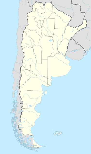
Hilario Ascasubi (Villarino Partido)
| Hilario Ascasubi | |
|---|---|
 Hilario Ascasubi Location in Argentina | |
| Coordinates: 39°22′S 62°38′W / 39.367°S 62.633°WCoordinates: 39°22′S 62°38′W / 39.367°S 62.633°W | |
| Country |
|
| Province |
|
| Partido | Villarino |
| Population (2005) | |
| • Total | 4,689 |
Hilario Ascasubi is a town in the southwest corner Buenos Aires Province, Argentina, in the partido of Villarino Partido. It is located on National Route 3 (Argentina). The town is named after Argentine poet Hilario Ascasubi, and railroad service opened in the town in 1913.
The town is located approximately 70 km south of Médanos (the capital of Villarino Partido), and 106 km south of Bahía Blanca, the nearest major city.
Climate
Hilario Ascasubi has borderline humid subtropical climate/semi-arid climate (Köppen climate classification Cfa/BSk).[1] with hot, summers and cooler, drier winters.
| Climate data for Hilario Ascasubi (1966–2013) | |||||||||||||
|---|---|---|---|---|---|---|---|---|---|---|---|---|---|
| Month | Jan | Feb | Mar | Apr | May | Jun | Jul | Aug | Sep | Oct | Nov | Dec | Year |
| Record high °C (°F) | 42.9 (109.2) |
39.6 (103.3) |
39.1 (102.4) |
32.6 (90.7) |
29.1 (84.4) |
26.9 (80.4) |
26.1 (79) |
28.5 (83.3) |
30.8 (87.4) |
33.8 (92.8) |
37.5 (99.5) |
39.7 (103.5) |
42.9 (109.2) |
| Average high °C (°F) | 29.7 (85.5) |
29.0 (84.2) |
25.5 (77.9) |
21.2 (70.2) |
17.3 (63.1) |
13.6 (56.5) |
13.6 (56.5) |
16.0 (60.8) |
18.7 (65.7) |
21.9 (71.4) |
25.3 (77.5) |
28.3 (82.9) |
21.7 (71.1) |
| Daily mean °C (°F) | 22.3 (72.1) |
21.2 (70.2) |
18.6 (65.5) |
14.8 (58.6) |
11.1 (52) |
8.0 (46.4) |
7.6 (45.7) |
9.3 (48.7) |
11.7 (53.1) |
14.6 (58.3) |
18.0 (64.4) |
20.8 (69.4) |
14.8 (58.6) |
| Average low °C (°F) | 14.0 (57.2) |
13.4 (56.1) |
11.5 (52.7) |
8.1 (46.6) |
4.8 (40.6) |
2.5 (36.5) |
1.7 (35.1) |
2.6 (36.7) |
4.6 (40.3) |
7.4 (45.3) |
10.4 (50.7) |
12.8 (55) |
7.8 (46) |
| Record low °C (°F) | 1.5 (34.7) |
1.4 (34.5) |
0.2 (32.4) |
−2.6 (27.3) |
−6.0 (21.2) |
−9.5 (14.9) |
−10.8 (12.6) |
−8.2 (17.2) |
−7.5 (18.5) |
−4.2 (24.4) |
−1.1 (30) |
1.7 (35.1) |
−10.8 (12.6) |
| Average precipitation mm (inches) | 49.4 (1.945) |
55.9 (2.201) |
62.4 (2.457) |
44.6 (1.756) |
28.1 (1.106) |
22.8 (0.898) |
22.0 (0.866) |
26.1 (1.028) |
37.2 (1.465) |
44.7 (1.76) |
44.0 (1.732) |
52.0 (2.047) |
492.0 (19.37) |
| Average relative humidity (%) | 57 | 60 | 67 | 68 | 73 | 75 | 72 | 67 | 64 | 63 | 58 | 57 | 65 |
| Mean monthly sunshine hours | 310.0 | 268.4 | 244.9 | 198.0 | 164.3 | 132.0 | 139.5 | 179.8 | 195.0 | 238.7 | 270.0 | 291.4 | 2,632 |
| Source: Instituto Nacional de Tecnología Agropecuaria[2] | |||||||||||||
See also
References
- ↑ Peel, M. C. and Finlayson, B. L. and McMahon, T. A. (2007). "Updated world map of the Köppen–Geiger climate classification" (PDF). Hydrol. Earth Syst. Sci. 11: 1633–1644. doi:10.5194/hess-11-1633-2007. ISSN 1027-5606.
- ↑ Cepeda, Jorge. "Estadística agrometeorológica histórica 1966–2013" (PDF) (in Spanish). Instituto Nacional de Tecnología Agropecuaria. Retrieved April 30, 2013.
This article is issued from Wikipedia - version of the 2/5/2016. The text is available under the Creative Commons Attribution/Share Alike but additional terms may apply for the media files.